Category:Maps of districts of Gauteng
Media in category "Maps of districts of Gauteng"
The following 11 files are in this category, out of 11 total.
-
 Map of Gauteng with Ekurhuleni highlighted (2016).svg 754 × 760; 223 KB
-
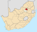
 Map of South Africa with Ekurhuleni highlighted (2016).svg 809 × 709; 672 KB
-
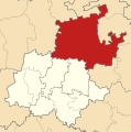
 Map of Gauteng with Johannesburg highlighted (2016).svg 754 × 760; 227 KB
-
 Map of South Africa with Johannesburg highlighted (2016).svg 809 × 709; 672 KB
-
 Map of Gauteng with Sedibeng highlighted (2011).svg 754 × 760; 162 KB
-
 Map of Gauteng with Sedibeng highlighted (2016).svg 754 × 760; 243 KB
-
 Map of South Africa with Sedibeng highlighted (2016).svg 809 × 709; 677 KB
-
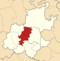
 Map of Gauteng with Tshwane highlighted (2016).svg 754 × 760; 228 KB
-
 Map of South Africa with Tshwane highlighted (2016).svg 809 × 709; 675 KB
-
 Map of Gauteng with West Rand highlighted (2016).svg 754 × 760; 226 KB
-
 Map of South Africa with West Rand highlighted (2016).svg 809 × 709; 673 KB
.svg)
.svg)
.svg)
.svg)
.svg)
.svg)
.svg)
.svg)
.svg)
.svg)
.svg)