Category:Maps of districts of Olomouc
Media in category "Maps of districts of Olomouc"
The following 31 files are in this category, out of 31 total.
-
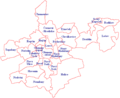
 Greater Olomouc.png 717 × 589; 27 KB
-
 Katastrální mapa Olomouce.png 778 × 614; 45 KB
-
 OL Bělidla.png 724 × 597; 23 KB
-
 OL Chomoutov.png 724 × 597; 23 KB
-
 OL Chválkovice.png 724 × 597; 23 KB
-
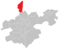
 OL Droždín.png 724 × 597; 23 KB
-
 OL Hejčín.png 724 × 597; 23 KB
-
 OL Hodolany.png 724 × 597; 23 KB
-
 OL Holice.png 724 × 597; 23 KB
-
 OL Klášterní Hradisko.png 724 × 597; 23 KB
-
 OL Lazce.png 724 × 597; 23 KB
-
 OL Lošov.png 724 × 597; 23 KB
-
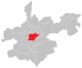 OL město.png 724 × 597; 23 KB
-
 OL Nedvězí.png 724 × 597; 23 KB
-
 OL Nemilany.png 724 × 597; 23 KB
-
 OL Neředín.png 724 × 597; 23 KB
-
 OL Nová Ulice.png 724 × 597; 23 KB
-
 OL Nové Sady.png 724 × 597; 23 KB
-
 OL Nový Svět.png 724 × 597; 23 KB
-
 OL Olomouc.png 2,817 × 2,137; 265 KB
-
 OL Pavlovičky.png 724 × 597; 23 KB
-
 OL Povel.png 724 × 597; 23 KB
-
 OL Radíkov.png 724 × 597; 23 KB
-
 OL Slavonín.png 724 × 597; 23 KB
-
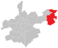
 OL Svatý Kopeček.png 724 × 597; 23 KB
-
 OL Topolany.png 724 × 597; 23 KB
-
 OL Týneček.png 724 × 597; 23 KB
-
 OL Černovír.png 724 × 597; 24 KB
-
 OL Řepčín.png 724 × 597; 23 KB
-
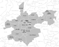
 Olomouc - městské části.png 696 × 571; 32 KB
-
 Velká Olomouc.PNG 865 × 768; 39 KB


