Category:Maps of districts of Plauen
Media in category "Maps of districts of Plauen"
The following 70 files are in this category, out of 70 total.
-
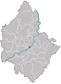
 Plauen Karte Gemarkungen.svg 855 × 1,139; 94 KB
-
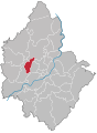
 Plauen - Chrieschwitz.svg 855 × 1,139; 84 KB
-
 Plauen - Großfriesen.svg 855 × 1,139; 84 KB
-
 Plauen - Haselbrunn.svg 855 × 1,139; 84 KB
-
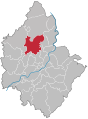
 Plauen - Innenstadt.svg 855 × 1,139; 84 KB
-
 Plauen - Jößnitz.svg 855 × 1,139; 84 KB
-
 Plauen - Kauschwitz.svg 855 × 1,139; 84 KB
-
 Plauen - Kleinfriesen.svg 855 × 1,139; 84 KB
-
 Plauen - Meßbach.svg 855 × 1,139; 84 KB
-
 Plauen - Neundorf.svg 855 × 1,139; 84 KB
-
 Plauen - Oberlosa.svg 855 × 1,139; 84 KB
-
 Plauen - Pfaffenhaus.svg 855 × 1,139; 84 KB
-
 Plauen - Innenstadt+Haselbrunn.svg 855 × 1,139; 67 KB
-
 Plauen - Reißig+Reißigwald.svg 855 × 1,139; 68 KB
-
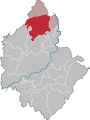
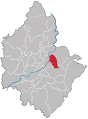
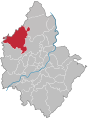
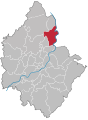
 Plauen - Stadtgebiet Nord.svg 850 × 1,151; 83 KB
-
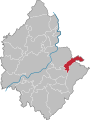
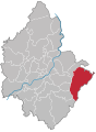
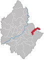
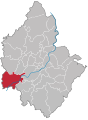
 Plauen - Stadtgebiet Ost.svg 850 × 1,151; 83 KB
-
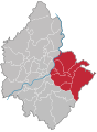
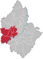
 Plauen - Stadtgebiet Süd.svg 850 × 1,151; 83 KB
-
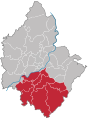
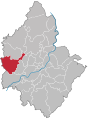
 Plauen - Stadtgebiet West.svg 850 × 1,151; 83 KB
-
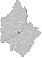
 Plauen - Stadtgebiet Zentrum.svg 850 × 1,151; 83 KB
-
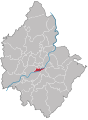
 Plauen Stadtteil Alt Chrieschwitz (301).svg 850 × 1,151; 83 KB
-
 Plauen Stadtteil Altstadt (101).svg 850 × 1,151; 83 KB
-
 Plauen Stadtteil Bahnhofsvorstadt (102).svg 850 × 1,151; 83 KB
-
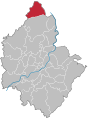
 Plauen Stadtteil Bärenstein (501).svg 850 × 1,151; 83 KB
-
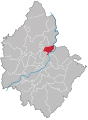
 Plauen Stadtteil Chrieschwitz (302).svg 850 × 1,151; 83 KB
-
 Plauen Stadtteil Dobenau (103).svg 850 × 1,151; 83 KB
-
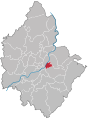
 Plauen Stadtteil Großfriesen (303).svg 850 × 1,151; 83 KB
-
 Plauen Stadtteil Hammertorvorstadt (201).svg 850 × 1,151; 83 KB
-
 Plauen Stadtteil Haselbrunn (202).svg 850 × 1,151; 83 KB
-
 Plauen Stadtteil Hofer Vorstadt (401).svg 850 × 1,151; 83 KB
-
 Plauen Stadtteil Jößnitz (207).svg 850 × 1,151; 83 KB
-
 Plauen Stadtteil Kauschwitz (209).svg 850 × 1,151; 83 KB
-
 Plauen Stadtteil Kleinfriesen (304).svg 850 × 1,151; 83 KB
-
 Plauen Stadtteil Meßbach (402).svg 850 × 1,151; 83 KB
-
 Plauen Stadtteil Neundorf (505).svg 850 × 1,151; 83 KB
-
 Plauen Stadtteil Neundorfer Vorstadt (502).svg 850 × 1,151; 83 KB
-
 Plauen Stadtteil Neustadt (104).svg 850 × 1,151; 83 KB
-
 Plauen Stadtteil Obere Aue (105).svg 850 × 1,151; 83 KB
-
 Plauen Stadtteil Oberlosa (403).svg 850 × 1,151; 83 KB
-
 Plauen Stadtteil Ostvorstadt (404).svg 850 × 1,151; 83 KB
-
 Plauen Stadtteil Preißelpöhl (203).svg 850 × 1,151; 83 KB
-
 Plauen Stadtteil Reichenbacher Vorstadt (306).svg 850 × 1,151; 83 KB
-
 Plauen Stadtteil Reinsdorf (405).svg 850 × 1,151; 83 KB
-
 Plauen Stadtteil Reißig (204).svg 850 × 1,151; 83 KB
-
 Plauen Stadtteil Reißiger Vorstadt (205).svg 850 × 1,151; 83 KB
-
 Plauen Stadtteil Reißigwald mit Lochhaus (206).svg 850 × 1,151; 83 KB
-
 Plauen Stadtteil Reusa mit Sorga (305).svg 850 × 1,151; 83 KB
-
 Plauen Stadtteil Röttis (211).svg 850 × 1,151; 83 KB
-
 Plauen Stadtteil Schlossberg (106).svg 850 × 1,151; 83 KB
-
 Plauen Stadtteil Siedlung Neundorf (503).svg 850 × 1,151; 83 KB
-
 Plauen Stadtteil Steinsdorf (208).svg 850 × 1,151; 83 KB
-
 Plauen Stadtteil Straßberg (506).svg 850 × 1,151; 83 KB
-
 Plauen Stadtteil Stöckigt (406).svg 850 × 1,151; 83 KB
-
 Plauen Stadtteil Syratal (504).svg 850 × 1,151; 83 KB
-
 Plauen Stadtteil Südvorstadt (407).svg 850 × 1,151; 83 KB
-
 Plauen Stadtteil Tauschwitz (307).svg 850 × 1,151; 83 KB
-
 Plauen Stadtteil Thiergarten (408).svg 850 × 1,151; 83 KB
-
 Plauen Stadtteil Unterlosa (409).svg 850 × 1,151; 83 KB
-
 Plauen Stadtteil Zwoschwitz (210).svg 850 × 1,151; 83 KB
-
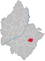
 Plauen - Reinsdorf.svg 855 × 1,139; 84 KB
-
 Plauen - Reißig.svg 855 × 1,139; 84 KB
-
 Plauen - Reißigwald.svg 855 × 1,139; 84 KB
-
 Plauen - Reusa mit Sorga.svg 855 × 1,139; 84 KB
-
 Plauen - Röttis.svg 855 × 1,139; 84 KB
-
 Plauen - Steinsdorf.svg 855 × 1,139; 84 KB
-
 Plauen - Straßberg.svg 855 × 1,139; 84 KB
-
 Plauen - Stöckigt.svg 855 × 1,139; 84 KB
-
 Plauen - Tauschwitz.svg 855 × 1,139; 84 KB
-
 Plauen - Thiergarten.svg 855 × 1,139; 84 KB
-
 Plauen - Unterlosa.svg 855 × 1,139; 84 KB
-
 Plauen - Zwoschwitz.svg 855 × 1,139; 84 KB


.svg)
.svg)
.svg)
.svg)
.svg)
.svg)
.svg)
.svg)
.svg)
.svg)
.svg)
.svg)
.svg)
.svg)
.svg)
.svg)
.svg)
.svg)
.svg)
.svg)
.svg)
.svg)
.svg)
.svg)
.svg)
.svg)
.svg)
.svg)
.svg)
.svg)
.svg)
.svg)
.svg)
.svg)
.svg)
.svg)
.svg)
.svg)
.svg)


