Category:Maps of districts of Zambia till 2016
Media in category "Maps of districts of Zambia till 2016"
The following 11 files are in this category, out of 11 total.
-
 Districts of Copperbelt Province Zambia.svg 519 × 465; 463 KB
-
 Districts of Eastern Province Zambia.svg 519 × 465; 502 KB
-
 Districts of Luapula Province Zambia.svg 519 × 465; 486 KB
-
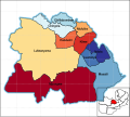
 Districts of Lusaka Province Zambia.svg 519 × 465; 400 KB
-
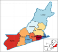
 Districts of Muchinga Province Zambia.svg 519 × 465; 577 KB
-
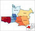 Districts of North-Western Province Zambia.svg 519 × 465; 673 KB
-
 Districts of Northern Province Zambia.svg 519 × 465; 581 KB
-
 Districts of Southern Province Zambia.svg 519 × 465; 541 KB
-
 Districts of Western Province Zambia.svg 519 × 465; 616 KB
-
 Maps of Zambias Districts 2.png 4,134 × 3,543; 243 KB
-
 Provincial Districts of Zambia Transparent.svg 519 × 465; 2.31 MB


