Category:Maps of districts of the Free State
Media in category "Maps of districts of the Free State"
The following 10 files are in this category, out of 10 total.
-
 Map of South Africa with Fezile Dabi highlighted (2016).svg 809 × 709; 719 KB
-
 Map of the Free State with Fezile Dabi highlighted (2016).svg 828 × 693; 682 KB
-
 Map of South Africa with Lejweleputswa highlighted (2016).svg 809 × 709; 720 KB
-
 Map of the Free State with Lejweleputswa highlighted (2016).svg 828 × 693; 684 KB
-
 Map of South Africa with Mangaung highlighted (2016).svg 809 × 709; 711 KB
-
 Map of the Free State with Mangaung highlighted (2016).svg 828 × 693; 659 KB
-
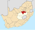
 Map of South Africa with Thabo Mofutsanyana highlighted (2016).svg 809 × 709; 724 KB
-
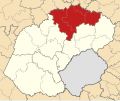
 Map of the Free State with Thabo Mofutsanyana highlighted (2016).svg 828 × 693; 698 KB
-
 Map of South Africa with Xhariep highlighted (2016).svg 809 × 709; 721 KB
-
 Map of the Free State with Xhariep highlighted (2016).svg 828 × 693; 691 KB
.svg)
.svg)
.svg)
.svg)
.svg)
.svg)
.svg)
.svg)
.svg)
.svg)