Category:Maps of earthquakes in East Timor
Media in category "Maps of earthquakes in East Timor"
The following 10 files are in this category, out of 10 total.
-
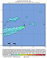
 2019-04-06 Dili, East Timor M6.3 earthquake intensity map (USGS).jpg 612 × 684; 78 KB
-
 2019-04-06 Dili, East Timor M6.3 earthquake shakemap (USGS).jpg 868 × 1,068; 149 KB
-

-
 2021-12-29 Lospalos, Timor Leste M7.3 earthquake shakemap (USGS).jpg 785 × 981; 183 KB
-

-
 2022-02-01 Lospalos, Timor Leste M6 earthquake shakemap (USGS).jpg 777 × 995; 148 KB
-

-
 2022-05-27 Lospalos, Timor Leste M6.1 earthquake shakemap (USGS).jpg 807 × 1,001; 98 KB
-

-
 2022-05-27 Lospalos, Timor Leste M6.2 earthquake shakemap (USGS).jpg 807 × 998; 95 KB
.jpg)
.jpg)
.jpg)
.jpg)
.jpg)
.jpg)
.jpg)
.jpg)
.jpg)
.jpg)