Category:Maps of earthquakes in southeast of the Loyalty Islands
Media in category "Maps of earthquakes in southeast of the Loyalty Islands"
The following 28 files are in this category, out of 28 total.
-
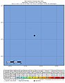
 2021-02-10 the Loyalty Islands M6 earthquake shakemap (USGS).jpg 786 × 996; 122 KB
-

-
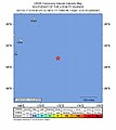
 2021-02-10 the Loyalty Islands M6.1 earthquake shakemap (USGS).jpg 786 × 998; 125 KB
-

-
 2021-02-10 the Loyalty Islands M6.2 earthquake shakemap (USGS).jpg 786 × 996; 129 KB
-

-
 2021-02-10 the Loyalty Islands M6.4 earthquake shakemap (USGS).jpg 786 × 997; 129 KB
-

-
 2021-02-10 the Loyalty Islands M7.7 earthquake shakemap (USGS).jpg 786 × 994; 167 KB
-
 2021-02-11 the Loyalty Islands M6 earthquake shakemap (USGS).jpg 786 × 997; 132 KB
-
-
 2021-02-17 the Loyalty Islands M6.1 earthquake shakemap (USGS).jpg 786 × 996; 129 KB
-

-
 2022-03-31 the Loyalty Islands M6.3 earthquake shakemap (USGS).jpg 787 × 1,002; 81 KB
-

-
 2022-03-31 the Loyalty Islands M6.4 earthquake shakemap (USGS).jpg 787 × 1,000; 81 KB
-

-
 2022-05-26 the Loyalty Islands M6.4 earthquake shakemap (USGS).jpg 787 × 1,001; 80 KB
-

-
 2022-05-26 the Loyalty Islands M6.6 earthquake shakemap (USGS).jpg 787 × 1,000; 82 KB
-

-
 2022-08-14 the Loyalty Islands M6.1 earthquake shakemap (USGS).jpg 787 × 1,000; 77 KB
-

-
 2022-08-14 the Loyalty Islands M6.2 earthquake shakemap (USGS).jpg 787 × 1,000; 78 KB
-

-
 2022-08-14 the Loyalty Islands M6.4 earthquake shakemap (USGS).jpg 787 × 1,000; 77 KB
-

-
 2022-12-28 the Loyalty Islands M6.1 earthquake shakemap (USGS).jpg 787 × 999; 80 KB
.jpg)
.jpg)
.jpg)
.jpg)
.jpg)
.jpg)
.jpg)
.jpg)
.jpg)
.jpg)
.jpg)
.jpg)
.jpg)
.jpg)
.jpg)
.jpg)
.jpg)
.jpg)
.jpg)
.jpg)
.jpg)
.jpg)
.jpg)
.jpg)
.jpg)
.jpg)
.jpg)
.jpg)