Category:Maps of forests in Dordogne (ZNIEFF)
Media in category "Maps of forests in Dordogne (ZNIEFF)"
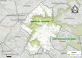
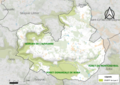
The following 11 files are in this category, out of 11 total.
-
 24011-Antonne-et-Trigonant-ZNIEFF2.png 5,866 × 4,133; 10.99 MB
-
 24050-Borrèze-ZNIEFF2.png 5,866 × 4,133; 11.63 MB
-
 24115-Château-l'Évêque-ZNIEFF2.png 5,866 × 4,133; 13.23 MB
-
 24196-Génis-ZNIEFF2.png 5,866 × 4,133; 11.17 MB
-
 24209-Hautefaye-ZNIEFF2.png 5,866 × 4,133; 4.08 MB
-
 24464-Saint-Mesmin-ZNIEFF2.png 5,866 × 4,133; 10.1 MB
-
 24478-Saint-Pardoux-et-Vielvic-ZNIEFF2.png 5,866 × 4,133; 9.19 MB
-
 24499-Saint-Sauveur-ZNIEFF2.png 5,866 × 4,133; 5.77 MB
-
 24507-Sainte-Trie-ZNIEFF2.png 5,866 × 4,133; 4.69 MB
-
 24515-Salagnac-ZNIEFF2.png 5,866 × 4,133; 4.74 MB
-
 24538-Siorac-en-Périgord-ZNIEFF2.png 5,866 × 4,133; 8.49 MB


