Category:Maps of former regions of France
| NO WIKIDATA ID FOUND! Search for Maps of former regions of France on Wikidata | |
| Upload media |
Administrative regions and territorial collectivity of Metropolitan France (‡ since start of 2016):
Auvergne-Rhône-Alpes‡ · Bourgogne-Franche-Comté‡ · Brittany · Centre-Val de Loire · Corsica · Grand Est‡ · Hauts-de-France‡ · Île-de-France · Normandy‡ · Nouvelle-Aquitaine‡ · Occitania‡ · Pays de la Loire · Provence-Alpes-Côte d'Azur
Former administrative regions of Metropolitan France (until end of 2015):
Alsace · Aquitaine · Auvergne · Burgundy · Champagne-Ardenne · Franche-Comté · Languedoc-Roussillon · Limousin · Lorraine · Midi-Pyrénées · Nord-Pas-de-Calais · Lower Normandy · Upper Normandy · Picardy · Poitou-Charentes · Rhône-Alpes
Overseas departments and regions: Guadeloupe · Martinique · French Guiana · Réunion · Mayotte
Overseas collectivities: Saint Barthélemy · Saint-Martin · Saint Pierre and Miquelon · French Polynesia · Wallis and Futuna · French Southern and Antarctic Lands+
Sui generis territories: New Caledonia · Clipperton Island+
Subcategories
This category has the following 2 subcategories, out of 2 total.
Media in category "Maps of former regions of France"
The following 22 files are in this category, out of 22 total.
-
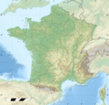
France relief location carte regions et departements.png 2,000 × 1,922; 4.96 MB
-
Frankrijk-met-regionamen.jpg 561 × 552; 49 KB
-
1005 regions colors.png 1,000 × 961; 98 KB
-
700x700 CARTE FRANCE GEO Regions R1.png 700 × 700; 819 KB
-
800x800-France-blank-Régions.jpg 800 × 800; 123 KB
-
Blasons et régions de France.jpg 632 × 600; 259 KB
-
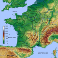
Carte France département région relief animé.gif 320 × 315; 417 KB
-
Carte France.png 559 × 577; 16 KB
-
Départements+régions+capitales(France).png 641 × 584; 184 KB
-
Four color theorem illustration looking at provinces of France.png 588 × 550; 70 KB
-
France 1914 Régions militaires.gif 650 × 645; 20 KB
-
France 1919 régions Clémentel.gif 650 × 645; 20 KB
-
France 1926 Conseils de préfectures interdépartementaux.gif 650 × 645; 20 KB
-
France 1926 régions postales.gif 650 × 645; 19 KB
-
France 1941 Préfectures régionales Etat français.gif 650 × 645; 19 KB
-
France location map3.png 614 × 582; 63 KB
-
France-region.png 526 × 556; 34 KB
-
France-RegionNumbered.png 526 × 556; 39 KB
-
FranceRegionsNumbered.png 200 × 189; 24 KB
-
Frankreich Départements.png 576 × 530; 84 KB
-
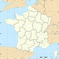
Régions françaises (fond de carte).png 1,000 × 961; 65 KB
-
Экономические районы Франции.png 929 × 748; 183 KB


