Category:Maps of former subdivisions of Lincolnshire
Media in category "Maps of former subdivisions of Lincolnshire"
The following 21 files are in this category, out of 21 total.
-
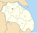
 Alford Urban District, Lindsey (1970).svg 686 × 612; 149 KB
-
 Barton upon Humber Urban District, Parts of Lindsey (1970).svg 686 × 612; 149 KB
-
 Brigg Urban District, Lindsey (1970).svg 686 × 612; 149 KB
-
 Caistor Rural District, Lindsey (1970).svg 686 × 612; 149 KB
-
 Gainsborough Rural District, Lindsey (1970).svg 686 × 612; 149 KB
-
 Gainsborough Urban District, Lindsey (1970).svg 686 × 612; 149 KB
-
 Glanford Brigg Rural District, Lindsey (1970).svg 686 × 612; 149 KB
-
 Grimsby Rural District, Lindsey (1970).svg 686 × 612; 149 KB
-
 Horncastle Rural District, Lindsey (1970).svg 686 × 612; 149 KB
-
 Horncastle Urban District, Lindsey (1970).svg 686 × 612; 149 KB
-
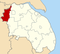 Isle of Axholme Rural District, Lindsey (1970).svg 686 × 612; 149 KB
-
 Louth Rural District, Lindsey (1970).svg 686 × 612; 149 KB
-
 Mablethorpe and Sutton Urban District, Lindsey (1970).svg 686 × 612; 149 KB
-
 Market Rasen Urban District, Lindsey (1970).svg 686 × 612; 149 KB
-
 Municipal Borough of Cleethorpes, Lindsey (1970).svg 686 × 612; 149 KB
-
 Municipal Borough of Louth, Lindsey (1970).svg 686 × 612; 149 KB
-
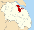
 Municipal Borough of Scunthorpe, Lindsey (1970).svg 686 × 612; 149 KB
-
 Skegness Urban District, Lindsey (1970).svg 686 × 612; 149 KB
-
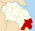 Spilsby Rural District, Lindsey (1970).svg 686 × 612; 149 KB
-
 Welton Rural District, Lindsey (1970).svg 686 × 612; 149 KB
-
 Woodhall Spa Urban District, Lindsey (1970).svg 686 × 612; 149 KB
.svg)
.svg)
.svg)
.svg)
.svg)
.svg)
.svg)
.svg)
.svg)
.svg)
.svg)
.svg)
.svg)
.svg)
.svg)
.svg)
.svg)
.svg)
.svg)
.svg)
.svg)