Category:Maps of geologic formations of the Signal Hill Group (Canada)
Media in category "Maps of geologic formations of the Signal Hill Group (Canada)"
The following 9 files are in this category, out of 9 total.
-
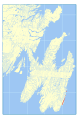
 Bay de Verde Formation map.svg 512 × 786; 26.5 MB
-
 Blackhead Formation map.svg 512 × 786; 26.47 MB
-
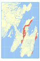
 Cape Ballard Formation map.svg 512 × 786; 26.44 MB
-
 Cappahayden Formation map.svg 512 × 786; 26.44 MB
-
 Cuckold Formation map.svg 512 × 786; 26.47 MB
-
 Ferryland Head Formation map.svg 512 × 786; 26.45 MB
-
 Flat Rock Cove Formation map.svg 512 × 786; 26.45 MB
-
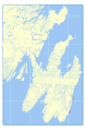
 Gibbett Hill Formation map.svg 512 × 786; 26.82 MB
-
 Quidi Vidi Formation map.svg 512 × 786; 26.48 MB


