Category:Maps of governorates of Lebanon between 1983 and 2003
Media in category "Maps of governorates of Lebanon between 1983 and 2003"
The following 14 files are in this category, out of 14 total.
-
 Divisions-Administratives-du-Liban-1983-2003.png 424 × 599; 64 KB
-
 GADM LBN Administrative Divisions.svg 491 × 630; 214 KB
-
 Governorates of Lebanon.png 600 × 740; 100 KB
-
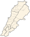 Lebanon districts.png 600 × 740; 61 KB
-
 Lebanon governorates english.png 500 × 642; 15 KB
-
 Lebanon governorates green.png 1,000 × 1,283; 57 KB
-
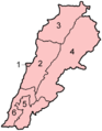 Lebanon governorates numbered geo.png 300 × 385; 8 KB
-
 Lebanon governorates numbered geo.svg 300 × 385; 45 KB
-
 Lebanon, administrative divisions - th - colored.svg 992 × 1,142; 322 KB
-
 LEBMAP.jpg 2,473 × 3,061; 917 KB
-
 Liban.PNG 543 × 767; 73 KB
-
 Liban.svg 600 × 740; 80 KB
-
 Location map Lebanon.PNG 559 × 600; 53 KB
-
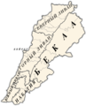
 Líbano.gif 424 × 599; 51 KB


