Category:Maps of groups of communes in Aube
Departments of Metropolitan France: Ain [01] · Aisne [02] · Allier [03] · Alpes-de-Haute-Provence [04] · Hautes-Alpes [05] · Alpes-Maritimes [06] · Ardèche [07] · Ardennes [08] · Ariège [09] · Aube [10] · Aude [11] · Aveyron [12] · Bouches-du-Rhône [13] · Calvados [14] · Cantal [15] · Charente [16] · Charente-Maritime [17] · Cher [18] · Corrèze [19] · Corse-du-Sud [2A]† · Haute-Corse [2B]† · Côte-d’Or [21] · Côtes-d'Armor [22] · Creuse [23] · Dordogne [24] · Doubs [25] · Drôme [26] · Eure [27] · Eure-et-Loir [28] · Finistère [29] · Gard [30] · Haute-Garonne [31] · Gers [32] · Gironde [33] · Hérault [34] · Ille-et-Vilaine [35] · Indre [36] · Indre-et-Loire [37] · Isère [38] · Jura [39] · Landes [40] · Loir-et-Cher [41] · Loire [42] · Haute-Loire [43] · Loire-Atlantique [44] · Loiret [45] · Lot [46] · Lot-et-Garonne [47] · Lozère [48] · Maine-et-Loire [49] · Manche [50] · Marne [51] · Haute-Marne [52] · Mayenne [53] · Meurthe-et-Moselle [54] · Meuse [55] · Morbihan [56] · Moselle [57] · Nièvre [58] · Nord [59] · Oise [60] · Orne [61] · Pas-de-Calais [62] · Puy-de-Dôme [63] · Pyrénées-Atlantiques [64] · Hautes-Pyrénées [65] · Pyrénées-Orientales [66] · Bas-Rhin [67] · Haut-Rhin [68] · departmental district of the Rhône [69] · Rhône [69D]‡ · Haute-Saône [70] · Saône-et-Loire [71] · Sarthe [72] · Savoie [73] · Haute-Savoie [74] · Seine-Maritime [76] · Seine-et-Marne [77] · Yvelines [78] · Deux-Sèvres [79] · Somme [80] · Tarn [81] · Tarn-et-Garonne [82] · Var [83] · Vaucluse [84] · Vendée [85] · Vienne [86] · Haute-Vienne [87] · Vosges [88] · Yonne [89] · Territoire de Belfort [90] · Essonne [91] · Hauts-de-Seine [92] · Seine-Saint-Denis [93] · Val-de-Marne [94] · Val-d'Oise [95]
Overseas departments and regions: Guadeloupe [971] · Martinique [972] · French Guiana [973] · Réunion [974] · Mayotte [976]
Sui generis territories: New Caledonia [988]
Overseas departments and regions: Guadeloupe [971] · Martinique [972] · French Guiana [973] · Réunion [974] · Mayotte [976]
Sui generis territories: New Caledonia [988]
| NO WIKIDATA ID FOUND! Search for Maps of groups of communes in Aube on Wikidata | |
| Upload media |
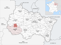
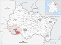
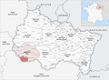
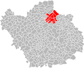
Français : Cartes des établissements publics de coopération intercommunale (communautés de communes, d’agglomération ou urbaines, métropoles, syndicats intercommunaux) et syndicats mixtes (dont les pôles métropolitains) du département français de l’Aube.

Subcategories
This category has the following 3 subcategories, out of 3 total.
Media in category "Maps of groups of communes in Aube"
The following 45 files are in this category, out of 45 total.
-
 Gemeindeverbände im Département Aube 2023.png 3,499 × 2,580; 2.96 MB
-
 10-Intercos-2019.png 3,507 × 2,480; 2.13 MB
-
 Gemeindeverband Arcis, Mailly, Ramerupt 2019.png 3,499 × 2,580; 2.72 MB
-
 Gemeindeverband Barséquanais en Champagne 2019.png 3,499 × 2,580; 2.72 MB
-
 Gemeindeverband Chaourçois et du Val d’Armance 2019.png 3,499 × 2,580; 2.72 MB
-
 Gemeindeverband Forêts, Lacs, Terres en Champagne 2019.png 3,499 × 2,580; 2.72 MB
-
 Gemeindeverband Lacs de Champagne 2019.png 3,499 × 2,580; 2.72 MB
-
 Localisation EPCI Arcis Mailly Ramerupt dans l'Aube, France.svg 1,000 × 806; 178 KB
-
 Localisation EPCI Bouilly Mogne Aumont dans l'Aube, France.svg 1,000 × 806; 166 KB
-
 Localisation EPCI de l'Arce et de l'Ource dans l'Aube, France.svg 1,000 × 806; 166 KB
-
 Localisation EPCI de l'Orvin et de l'Ardusson dans l'Aube, France.svg 1,000 × 806; 166 KB
-
 Localisation EPCI de la région d'Arcis-sur-Aube dans l'Aube, France.svg 1,000 × 806; 166 KB
-
 Localisation EPCI de la région de Bar-sur-Aube dans l'Aube, France.svg 1,000 × 806; 166 KB
-
 Localisation EPCI de la région de Ramerupt dans l'Aube, France.svg 1,000 × 806; 165 KB
-
 Localisation EPCI de la région des Riceys dans l'Aube, France.svg 1,000 × 806; 165 KB
-
 Localisation EPCI de Plancy-l'Abbaye dans l'Aube, France.svg 1,000 × 806; 165 KB
-
 Localisation EPCI de Soulaines dans l'Aube, France.svg 1,000 × 806; 166 KB
-
 Localisation EPCI de Vendeuvre-Soulaines dans l'Aube, France.svg 1,000 × 806; 178 KB
-
 Localisation EPCI des lacs de Champagne dans l'Aube, France.svg 1,000 × 806; 166 KB
-
 Localisation EPCI des portes de Romilly-sur-Seine dans l'Aube, France.svg 1,000 × 806; 165 KB
-
 Localisation EPCI des portes du Pays d'Othe dans l'Aube, France.svg 1,000 × 806; 165 KB
-
 Localisation EPCI des rivières dans l'Aube, France.svg 1,000 × 806; 166 KB
-
 Localisation EPCI du Barséquanais dans l'Aube, France.svg 1,000 × 806; 166 KB
-
 Localisation EPCI du Barséquanais en Champagne dans l'Aube, France.svg 1,000 × 806; 180 KB
-
 Localisation EPCI du Briennois dans l'Aube, France.svg 1,000 × 806; 166 KB
-
 Localisation EPCI du Chaourçois dans l'Aube, France.svg 1,000 × 806; 166 KB
-
 Localisation EPCI du Chaourçois et du Val d'Armance dans l'Aube, France.svg 1,000 × 806; 175 KB
-
 Localisation EPCI du Chavangeois dans l'Aube, France.svg 1,000 × 806; 165 KB
-
 Localisation EPCI du Nogentais dans l'Aube, France.svg 1,000 × 806; 166 KB
-
 Localisation EPCI du nord de l'Aube dans l'Aube, France.svg 1,000 × 806; 165 KB
-
 Localisation EPCI du Pays d'Othe aixois dans l'Aube, France.svg 1,000 × 806; 165 KB
-
 Localisation EPCI du val d'Armance dans l'Aube, France.svg 1,000 × 806; 166 KB
-
 Localisation EPCI Forêts, lacs, terres en Champagne dans l'Aube, France.svg 1,000 × 806; 165 KB
-
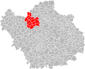
 Localisation EPCI Grand Troyes dans l'Aube, France.svg 1,000 × 806; 166 KB
-
 Localisation EPCI Seine Barse dans l'Aube, France.svg 1,000 × 806; 165 KB
-
 Localisation EPCI Seine Fontaine Beauregard dans l'Aube, France.svg 1,000 × 806; 166 KB
-
 Localisation EPCI Seine, Melda, Coteaux dans l'Aube, France.svg 1,000 × 806; 166 KB
-
 Gemeindeverband Nogentais 2019.png 3,499 × 2,580; 2.72 MB
-
 Gemeindeverband Orvin et Ardusson 2019.png 3,499 × 2,580; 2.72 MB
-
 Gemeindeverband Pays d’Othe 2019.png 3,499 × 2,580; 2.72 MB
-
 Gemeindeverband Portes de Romilly-sur-Seine 2019.png 3,499 × 2,580; 2.71 MB
-
 Gemeindeverband Région de Bar-sur-Aube 2019.png 3,499 × 2,580; 2.72 MB
-
 Gemeindeverband Seine et Aube 2019.png 3,499 × 2,580; 2.72 MB
-
 Gemeindeverband Troyes Champagne Métropole 2019.png 3,499 × 2,580; 2.72 MB
-
 Gemeindeverband Vendeuvre-Soulaines 2019.png 3,499 × 2,580; 2.72 MB


