Category:Maps of groups of communes in Haute-Garonne to 2016
Media in category "Maps of groups of communes in Haute-Garonne to 2016"
The following 34 files are in this category, out of 34 total.
-
 Localisation EPCI Axe-sud dans la Haute-Garonne, France.svg 1,000 × 1,051; 215 KB
-
 Localisation EPCI Cap lauragais dans la Haute-Garonne, France.svg 1,000 × 1,051; 215 KB
-
 Localisation EPCI Coteaux du Lauragais sud dans la Haute-Garonne, France.svg 1,000 × 1,051; 215 KB
-
 Localisation EPCI Coteaux du Savès et de l'Aussonnelle dans la Haute-Garonne, France.svg 1,000 × 1,051; 215 KB
-
 Localisation EPCI Cœur lauragais dans la Haute-Garonne, France.svg 1,000 × 1,051; 216 KB
-
 Localisation EPCI de Garonne Lougé dans la Haute-Garonne, France.svg 1,000 × 1,051; 215 KB
-
 Localisation EPCI de la Louge et du Touch dans la Haute-Garonne, France.svg 1,000 × 1,051; 215 KB
-
 Localisation EPCI de la Save au Touch dans la Haute-Garonne, France.svg 1,000 × 1,051; 215 KB
-
 Localisation EPCI de la vallée de l'Ariège dans la Haute-Garonne, France.svg 1,000 × 1,051; 215 KB
-
 Localisation EPCI de Lèze Ariège Garonne dans la Haute-Garonne, France.svg 1,000 × 1,051; 215 KB
-
 Localisation EPCI de Save et Garonne dans la Haute-Garonne, France.svg 1,000 × 1,051; 215 KB
-
 Localisation EPCI des Coteaux Bellevue dans la Haute-Garonne, France.svg 1,000 × 1,051; 216 KB
-
 Localisation EPCI des Coteaux du Girou dans la Haute-Garonne, France.svg 1,000 × 1,051; 215 KB
-
 Localisation EPCI des portes du Comminges dans la Haute-Garonne, France.svg 1,000 × 1,051; 180 KB
-
 Localisation EPCI des trois vallées dans la Haute-Garonne, France.svg 1,000 × 1,051; 215 KB
-
 Localisation EPCI du Boulonnais dans la Haute-Garonne, France.svg 1,000 × 1,051; 216 KB
-
 Localisation EPCI du canton d'Aurignac dans la Haute-Garonne, France.svg 1,000 × 1,051; 215 KB
-
 Localisation EPCI du canton de Cadours dans la Haute-Garonne, France.svg 1,000 × 1,051; 215 KB
-
 Localisation EPCI du canton de Cazères dans la Haute-Garonne, France.svg 1,000 × 1,051; 215 KB
-
 Localisation EPCI du canton de Saint-Béat dans la Haute-Garonne, France.svg 1,000 × 1,051; 215 KB
-
 Localisation EPCI du canton de Saint-Martory dans la Haute-Garonne, France.svg 1,000 × 1,051; 215 KB
-
 Localisation EPCI du canton de Salies-du-Salat dans la Haute-Garonne, France.svg 1,000 × 1,051; 215 KB
-
 Localisation EPCI du Frontonnais dans la Haute-Garonne, France.svg 1,000 × 1,051; 215 KB
-
 Localisation EPCI du haut Comminges dans la Haute-Garonne, France.svg 1,000 × 1,051; 215 KB
-
 Localisation EPCI du Muretain dans la Haute-Garonne, France.svg 1,000 × 1,051; 223 KB
-
 Localisation EPCI du pays de Luchon dans la Haute-Garonne, France.svg 1,000 × 1,051; 216 KB
-
 Localisation EPCI du Saint-Gaudinois dans la Haute-Garonne, France.svg 1,000 × 1,051; 215 KB
-
 Localisation EPCI du Savès dans la Haute-Garonne, France.svg 1,000 × 1,051; 215 KB
-
 Localisation EPCI du Sicoval dans la Haute-Garonne, France.svg 1,000 × 1,051; 216 KB
-
 Localisation EPCI du Volvestre dans la Haute-Garonne, France.svg 1,000 × 1,051; 216 KB
-
 Localisation EPCI Lauragais Revel Sorèzois dans la Haute-Garonne, France.svg 1,122 × 1,052; 200 KB
-
 Localisation EPCI Nebouzan - Rivière - Verdun dans la Haute-Garonne, France.svg 1,000 × 1,051; 215 KB
-
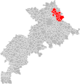
 Localisation EPCI Toulouse Métropole dans la Haute-Garonne, France.svg 1,000 × 1,051; 216 KB
-
 Localisation EPCI Val'Aïgo dans la Haute-Garonne, France.svg 1,000 × 1,051; 215 KB


