Category:Maps of historic districts on the National Register of Historic Places in Albany, New York
Maps of historic districts listed on the National Register of Historic Places in Albany, NY, USA
Media in category "Maps of historic districts on the National Register of Historic Places in Albany, New York"
The following 4 files are in this category, out of 4 total.
-
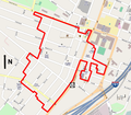
 Arbor Hill Historic District-Ten Broeck Triangle map.png 685 × 798; 175 KB
-
 Center Square-Hudson Park Historic District map.png 545 × 674; 391 KB
-
 Lafayette Park Historic District map.svg 845 × 546; 149 KB
-
 South End-Groebeckville Historic District map.png 1,000 × 875; 531 KB


