Category:Maps of historical regions of Latvia
Media in category "Maps of historical regions of Latvia"
The following 29 files are in this category, out of 29 total.
-
 3-Regiony Lotysska.PNG 1,188 × 727; 174 KB
-
 Historical regions of Latvia mk.svg 1,220 × 720; 990 KB
-
 Historical regions of Latvia.svg 1,220 × 720; 689 KB
-
 Koknese.jpg 655 × 335; 70 KB
-
 Kurzeme location Latvia.svg 1,220 × 720; 447 KB
-
 Kurzeme LocMap.png 350 × 212; 33 KB
-
 Latgale location Latvia.svg 1,220 × 720; 447 KB
-
 Latgale LocMap.png 350 × 212; 33 KB
-
 Latvia Base Map.png 1,110 × 689; 284 KB
-
 Latvia-hist-regions-(blank).png 842 × 524; 9 KB
-
 Latvia-hist-regions-(LT).png 842 × 524; 12 KB
-
 Latvian regions and latvians-(LT).png 600 × 370; 15 KB
-
 Latvian regions and latvians.png 600 × 370; 51 KB
-
 Latvija novadi un pilsetas.png 1,000 × 590; 191 KB
-
 Latvija viki-LT.gif 1,001 × 620; 45 KB
-
 Latvija viki.PNG 1,001 × 620; 107 KB
-
 Mappa della Livonia.png 414 × 223; 21 KB
-
 Mappa della Semgallia.png 414 × 223; 19 KB
-
 Regionen Lettlands.PNG 600 × 370; 30 KB
-
 Regionlettonie.png 2,000 × 1,194; 60 KB
-
 Regiuni cultural istorice ale Letoniei.png 1,001 × 620; 110 KB
-
 Selija LocMap.png 350 × 212; 33 KB
-
 Sēlija location Latvia.svg 1,220 × 720; 447 KB
-
 Vidzeme location Latvia.svg 1,220 × 720; 447 KB
-
 Vidzeme LocMap.png 350 × 212; 32 KB
-
 Zemgale location Latvia.svg 1,220 × 720; 447 KB
-
 Zemgale LocMap.png 350 × 212; 32 KB
-
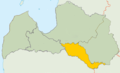
 Zemgale LocMap2.png 350 × 212; 32 KB
-
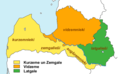
 Łotwa-historyczne dzielnice mapka.png 350 × 215; 37 KB


.png)
.png)


.png)