Category:Maps of islands of the Philippines
Subcategories
This category has the following 4 subcategories, out of 4 total.
Media in category "Maps of islands of the Philippines"
The following 19 files are in this category, out of 19 total.
-
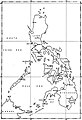
 Atlas of the Philippine Islands (1900) map 13.jpg 5,000 × 6,000; 4.2 MB
-
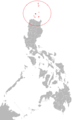 Babuyan and Batanes.png 2,000 × 3,120; 216 KB
-
 Calamian Islands Red.png 2,000 × 3,120; 215 KB
-
 Cebu Island Red.png 2,000 × 3,120; 211 KB
-
 Las islas de poniente (1521).png 2,000 × 3,120; 211 KB
-
 Las islas de san lazaro (1521).png 2,000 × 3,120; 213 KB
-
 Las islas felipenas (1543).png 2,000 × 3,120; 197 KB
-
 Leyte Island Red.png 2,000 × 3,120; 211 KB
-
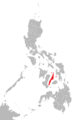
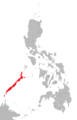
 Luzon Island Red.png 2,000 × 3,120; 216 KB
-
 Map of the Philippines.jpg 568 × 828; 122 KB
-
 Mindanao Island Red.png 2,000 × 3,120; 180 KB
-
 Mindanao Red.png 2,000 × 3,120; 215 KB
-
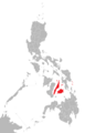
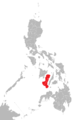
 Mindoro Island Red.png 2,000 × 3,120; 46 KB
-
 Negros Island Red.png 2,000 × 3,120; 211 KB
-
 Palawan Island Red.png 2,000 × 3,120; 211 KB
-
 Panay Island Red.png 2,000 × 3,120; 210 KB
-
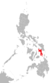
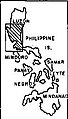
 Ph locator map ambos camarines.PNG 2,000 × 3,120; 63 KB
-
 Philippines Manila Locator.jpg 144 × 253; 45 KB
-
 Philippines Red.png 2,000 × 3,120; 211 KB
_map_13.jpg)


.png)
.png)
.png)


