Category:Maps of lakes of Canada
Subcategories
This category has the following 8 subcategories, out of 8 total.
Media in category "Maps of lakes of Canada"
The following 15 files are in this category, out of 15 total.
-
Artillery Lake Northwest Territories Canada locator 01.jpg 1,486 × 932; 1.15 MB
-
Blackwater Lake Northwest Territories Canada locator 01.jpg 1,486 × 932; 1.15 MB
-
Bras d'Or Lake.PNG 785 × 565; 145 KB
-
Canada.A2002236.1810.721.250m NASA.jpg 661 × 941; 237 KB
-
Champlainmap.svg 465 × 470; 99 KB
-
Explorations in the far North (1898) (20765047582).jpg 2,452 × 3,800; 1.39 MB
-
Lac Bressani 006.jpg 814 × 480; 19 KB
-
Lac Croche.png 1,467 × 2,582; 544 KB
-
Lac Sylvère.png 1,473 × 2,588; 398 KB
-
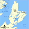
Lake Ainslie map.png 1,000 × 1,008; 323 KB
-
Lake Beechey.png 1,008 × 784; 174 KB
-
Mudzenchoot-lake-contour.png 1,475 × 933; 247 KB
-
Peak Lake location.jpg 248 × 251; 14 KB
-
Waterhen Sectional Map 222 (1918) (3743920874).jpg 9,840 × 6,763; 8.28 MB
-
Wekusko Sectional Map 422 (1918) (3740170060).jpg 8,861 × 6,338; 6.25 MB


