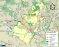
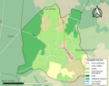
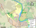
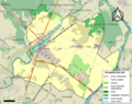
Category:Maps of land use of communes in Maine-et-Loire
Departments of Metropolitan France: Ain [01] · Aisne [02] · Allier [03] · Alpes-de-Haute-Provence [04] · Hautes-Alpes [05] · Alpes-Maritimes [06] · Ardèche [07] · Ardennes [08] · Ariège [09] · Aube [10] · Aude [11] · Aveyron [12] · Bouches-du-Rhône [13] · Calvados [14] · Cantal [15] · Charente [16] · Charente-Maritime [17] · Cher [18] · Corrèze [19] · Corse-du-Sud [2A]† · Haute-Corse [2B]† · Côte-d’Or [21] · Côtes-d'Armor [22] · Creuse [23] · Dordogne [24] · Doubs [25] · Drôme [26] · Eure [27] · Eure-et-Loir [28] · Finistère [29] · Gard [30] · Haute-Garonne [31] · Gers [32] · Gironde [33] · Hérault [34] · Ille-et-Vilaine [35] · Indre [36] · Indre-et-Loire [37] · Isère [38] · Jura [39] · Landes [40] · Loir-et-Cher [41] · Loire [42] · Haute-Loire [43] · Loire-Atlantique [44] · Loiret [45] · Lot [46] · Lot-et-Garonne [47] · Lozère [48] · Maine-et-Loire [49] · Manche [50] · Marne [51] · Haute-Marne [52] · Mayenne [53] · Meurthe-et-Moselle [54] · Meuse [55] · Morbihan [56] · Moselle [57] · Nièvre [58] · Nord [59] · Oise [60] · Orne [61] · Pas-de-Calais [62] · Puy-de-Dôme [63] · Pyrénées-Atlantiques [64] · Hautes-Pyrénées [65] · Pyrénées-Orientales [66] · Bas-Rhin [67] · Haut-Rhin [68] · departmental district of the Rhône [69] · Rhône [69D]‡ · Metropolis of Lyon [69M]‡ · Haute-Saône [70] · Saône-et-Loire [71] · Sarthe [72] · Savoie [73] · Haute-Savoie [74] · Seine-Maritime [76] · Seine-et-Marne [77] · Yvelines [78] · Deux-Sèvres [79] · Somme [80] · Tarn [81] · Tarn-et-Garonne [82] · Var [83] · Vaucluse [84] · Vendée [85] · Vienne [86] · Haute-Vienne [87] · Vosges [88] · Yonne [89] · Territoire de Belfort [90] · Essonne [91] · Hauts-de-Seine [92] · Seine-Saint-Denis [93] · Val-de-Marne [94] · Val-d'Oise [95]
Media in category "Maps of land use of communes in Maine-et-Loire"
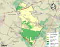
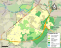
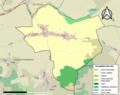
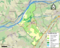
The following 177 files are in this category, out of 177 total.
-
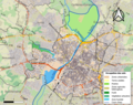
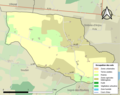
 49002-Allonnes-Sols.png 3,270 × 2,598; 3.51 MB
-
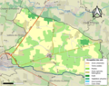
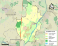
 49003-Tuffalun-Sols.png 3,270 × 2,598; 2.96 MB
-
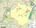
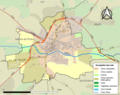
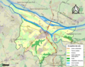
 49007-Angers-Sols.png 3,270 × 2,598; 7.22 MB
-
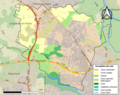
 49008-Angrie-Sols.png 3,270 × 2,598; 2.18 MB
-
 49009-Antoigné-Sols.png 3,270 × 2,598; 1.51 MB
-
 49010-Armaillé-Sols.png 3,270 × 2,598; 1.64 MB
-
 49011-Artannes-sur-Thouet-Sols.png 3,270 × 2,598; 2.15 MB
-
 49012-Aubigné-sur-Layon-Sols.png 3,270 × 2,598; 1.52 MB
-
 49015-Avrillé-Sols.png 3,270 × 2,598; 4.26 MB
-
 49017-Baracé-Sols.png 3,270 × 2,598; 1.28 MB
-
 49018-Baugé-en-Anjou-Sols.png 3,270 × 2,598; 5.34 MB
-
 49020-Beaucouzé-Sols.png 3,270 × 2,598; 4.42 MB
-
 49021-Beaufort-en-Anjou-Sols.png 3,270 × 2,598; 3.87 MB
-
 49022-Beaulieu-sur-Layon-Sols.png 3,270 × 2,598; 2.39 MB
-
 49023-Beaupréau-en-Mauges-Sols.png 3,270 × 2,598; 6.06 MB
-
 49026-Bécon-les-Granits-Sols.png 3,270 × 2,598; 2.33 MB
-
 49027-Bégrolles-en-Mauges-Sols.png 3,270 × 2,598; 2.75 MB
-
 49028-Béhuard-Sols.png 3,270 × 2,598; 1.88 MB
-
 49029-Blaison-Saint-Sulpice-Sols.png 3,270 × 2,598; 3.36 MB
-
 49030-Blou-Sols.png 3,270 × 2,598; 2.74 MB
-
 49035-Bouchemaine-Sols.png 3,270 × 2,598; 3.47 MB
-
 49036-Bouillé-Ménard-Sols.png 3,270 × 2,598; 1.86 MB
-
 49038-Bourg-l'Évêque-Sols.png 3,270 × 2,598; 900 KB
-
 49041-Brain-sur-Allonnes-Sols.png 3,270 × 2,598; 2.32 MB
-
 49045-La Breille-les-Pins-Sols.png 3,270 × 2,598; 1.78 MB
-
 49048-Briollay-Sols.png 3,270 × 2,598; 2.24 MB
-
 49050-Brissac-Loire-Aubance-Sols.png 3,270 × 2,598; 5.4 MB
-
 49053-Brossay-Sols.png 3,270 × 2,598; 1.08 MB
-
 49054-Candé-Sols.png 3,270 × 2,598; 2.03 MB
-
 49055-Cantenay-Épinard-Sols.png 3,270 × 2,598; 2.46 MB
-
 49056-Carbay-Sols.png 3,270 × 2,598; 1.05 MB
-
 49057-Cernusson-Sols.png 3,270 × 2,598; 1.94 MB
-
 49058-Les Cerqueux-Sols.png 3,270 × 2,598; 2.1 MB
-
 49060-Bellevigne-les-Châteaux-Sols.png 3,270 × 2,598; 3.68 MB
-
 49061-Challain-la-Potherie-Sols.png 3,270 × 2,598; 2.21 MB
-
 49063-Chalonnes-sur-Loire-Sols.png 3,270 × 2,598; 3.69 MB
-
 49064-Chambellay-Sols.png 3,270 × 2,598; 1.89 MB
-
 49067-Chenillé-Champteussé-Sols.png 3,270 × 2,598; 1.92 MB
-
 49068-Champtocé-sur-Loire-Sols.png 3,270 × 2,598; 2.68 MB
-
 49069-Orée-d'Anjou-Sols.png 3,270 × 2,598; 5.47 MB
-
 49070-Chanteloup-les-Bois-Sols.png 3,270 × 2,598; 1.9 MB
-
 49076-La Chapelle-Saint-Laud-Sols.png 3,270 × 2,598; 1.92 MB
-
 49080-Les Hauts-d'Anjou-Sols.png 3,270 × 2,598; 3.74 MB
-
 49082-Chaudefonds-sur-Layon-Sols.png 3,270 × 2,598; 2.56 MB
-
 49086-Terranjou-Sols.png 3,270 × 2,598; 3.87 MB
-
 49089-Chazé-sur-Argos-Sols.png 3,270 × 2,598; 2.36 MB
-
 49090-Cheffes-Sols.png 3,270 × 2,598; 1.72 MB
-
 49092-Chemillé-en-Anjou-Sols.png 3,270 × 2,598; 5.65 MB
-
 49099-Cholet-Sols.png 3,270 × 2,598; 5.72 MB
-
 49100-Cizay-la-Madeleine-Sols.png 3,270 × 2,598; 2.56 MB
-
 49102-Cléré-sur-Layon-Sols.png 3,270 × 2,598; 1.79 MB
-
 49107-Cornillé-les-Caves-Sols.png 3,270 × 2,598; 1.91 MB
-
 49109-Coron-Sols.png 3,270 × 2,598; 2.57 MB
-
 49110-Corzé-Sols.png 3,270 × 2,598; 2.67 MB
-
 49112-Le Coudray-Macouard-Sols.png 3,270 × 2,598; 2.13 MB
-
 49113-Courchamps-Sols.png 3,270 × 2,598; 1.34 MB
-
 49114-Courléon-Sols.png 3,270 × 2,598; 1.18 MB
-
 49120-Denée-Sols.png 3,270 × 2,598; 3.14 MB
-
 49121-Dénezé-sous-Doué-Sols.png 3,270 × 2,598; 1.98 MB
-
 49123-Distré-Sols.png 3,270 × 2,598; 2.63 MB
-
 49125-Doué-en-Anjou-Sols.png 3,270 × 2,598; 4.96 MB
-
 49127-Durtal-Sols.png 3,270 × 2,598; 3.55 MB
-
 49129-Écouflant-Sols.png 3,270 × 2,598; 3.88 MB
-
 49130-Écuillé-Sols.png 3,270 × 2,598; 1.58 MB
-
 49131-Épieds-Sols.png 3,270 × 2,598; 2.62 MB
-
 49132-Étriché-Sols.png 3,270 × 2,598; 2.32 MB
-
 49135-Feneu-Sols.png 3,270 × 2,598; 2.72 MB
-
 49138-Les Bois d'Anjou-Sols.png 3,270 × 2,598; 4.27 MB
-
 49140-Fontevraud-l'Abbaye-Sols.png 3,270 × 2,598; 1.76 MB
-
 49155-Grez-Neuville-Sols.png 3,270 × 2,598; 2.53 MB
-
 49160-Ingrandes-le-Fresne-sur-Loire-Sols.png 3,270 × 2,598; 2.24 MB
-
 49161-La Jaille-Yvon-Sols.png 3,270 × 2,598; 1.49 MB
-
 49163-Jarzé Villages-Sols.png 3,270 × 2,598; 3.15 MB
-
 49167-Les Garennes-sur-Loire-Sols.png 3,270 × 2,598; 3.75 MB
-
 49170-Juvardeil-Sols.png 3,270 × 2,598; 2.43 MB
-
 49171-La Lande-Chasles-Sols.png 3,270 × 2,598; 1.12 MB
-
 49174-Huillé-Lézigné-Sols.png 3,270 × 2,598; 2.49 MB
-
 49176-Le Lion-d'Angers-Sols.png 3,270 × 2,598; 3.11 MB
-
 49178-Loiré-Sols.png 3,270 × 2,598; 2.08 MB
-
 49180-Longué-Jumelles-Sols.png 3,270 × 2,598; 5.15 MB
-
 49182-Louresse-Rochemenier-Sols.png 3,270 × 2,598; 2.72 MB
-
 49183-Val-d'Erdre-Auxence-Sols.png 3,270 × 2,598; 2.92 MB
-
 49188-Marcé-Sols.png 3,270 × 2,598; 1.99 MB
-
 49192-Maulévrier-Sols.png 3,270 × 2,598; 2.73 MB
-
 49193-Le May-sur-Èvre-Sols.png 3,270 × 2,598; 2.71 MB
-
 49194-Mazé-Milon-Sols.png 3,270 × 2,598; 3.84 MB
-
 49195-Mazières-en-Mauges-Sols.png 3,270 × 2,598; 2.13 MB
-
 49200-Longuenée-en-Anjou-Sols.png 3,270 × 2,598; 3.78 MB
-
 49201-La Ménitré-Sols.png 3,270 × 2,598; 2.99 MB
-
 49205-Miré-Sols.png 3,270 × 2,598; 1.79 MB
-
 49209-Montigné-lès-Rairies-Sols.png 3,270 × 2,598; 1.22 MB
-
 49211-Montilliers-Sols.png 3,270 × 2,598; 2.45 MB
-
 49214-Montreuil-Juigné-Sols.png 3,270 × 2,598; 2.91 MB
-
 49215-Montreuil-Bellay-Sols.png 3,270 × 2,598; 2.83 MB
-
 49216-Montreuil-sur-Loir-Sols.png 3,270 × 2,598; 2.08 MB
-
 49217-Montreuil-sur-Maine-Sols.png 3,270 × 2,598; 1.78 MB
-
 49218-Montrevault-sur-Èvre-Sols.png 3,270 × 2,598; 5.5 MB
-
 49219-Montsoreau-Sols.png 3,270 × 2,598; 1.66 MB
-
 49220-Morannes sur Sarthe-Daumeray-Sols.png 3,270 × 2,598; 3.78 MB
-
 49221-Mouliherne-Sols.png 3,270 × 2,598; 2.26 MB
-
 49222-Mozé-sur-Louet-Sols.png 3,270 × 2,598; 3.71 MB
-
 49223-Mûrs-Erigné-Sols.png 3,270 × 2,598; 2.85 MB
-
 49224-Neuillé-Sols.png 3,270 × 2,598; 2.25 MB
-
 49228-Noyant-Villages-Sols.png 3,270 × 2,598; 5.09 MB
-
 49231-Nuaillé-Sols.png 3,270 × 2,598; 1.72 MB
-
 49235-Parnay-Sols.png 3,270 × 2,598; 2.02 MB
-
 49236-Passavant-sur-Layon-Sols.png 3,270 × 2,598; 1.38 MB
-
 49237-La Pellerine-Sols.png 3,270 × 2,598; 1.28 MB
-
 49240-La Plaine-Sols.png 3,270 × 2,598; 1.82 MB
-
 49241-Le Plessis-Grammoire-Sols.png 3,270 × 2,598; 2.58 MB
-
 49244-Mauges-sur-Loire-Sols.png 3,270 × 2,598; 5.54 MB
-
 49246-Les Ponts-de-Cé-Sols.png 3,270 × 2,598; 4.82 MB
-
 49247-La Possonnière-Sols.png 3,270 × 2,598; 2.23 MB
-
 49248-Ombrée-d'Anjou-Sols.png 3,270 × 2,598; 4.75 MB
-
 49253-Le Puy-Notre-Dame-Sols.png 3,270 × 2,598; 2.12 MB
-
 49257-Les Rairies-Sols.png 3,270 × 2,598; 1.7 MB
-
 49259-Rochefort-sur-Loire-Sols.png 3,270 × 2,598; 3.06 MB
-
 49260-La Romagne-Sols.png 3,270 × 2,598; 1.92 MB
-
 49261-Gennes-Val-de-Loire-Sols.png 3,270 × 2,598; 5.24 MB
-
 49262-Rou-Marson-Sols.png 3,270 × 2,598; 1.87 MB
-
 49266-Saint-Augustin-des-Bois-Sols.png 3,270 × 2,598; 1.82 MB
-
 49267-Saint-Barthélemy-d'Anjou-Sols.png 3,270 × 2,598; 4.64 MB
-
 49269-Saint-Christophe-du-Bois-Sols.png 3,270 × 2,598; 3.72 MB
-
 49271-Saint-Clément-de-la-Place-Sols.png 3,270 × 2,598; 2.71 MB
-
 49272-Saint-Clément-des-Levées-Sols.png 3,270 × 2,598; 2.9 MB
-
 49278-Sainte-Gemmes-sur-Loire-Sols.png 3,270 × 2,598; 4.85 MB
-
 49283-Saint-Georges-sur-Loire-Sols.png 3,270 × 2,598; 2.88 MB
-
 49284-Saint-Germain-des-Prés-Sols.png 3,270 × 2,598; 2.84 MB
-
 49288-Saint-Jean-de-la-Croix-Sols.png 3,270 × 2,598; 1.09 MB
-
 49291-Saint-Just-sur-Dive-Sols.png 3,270 × 2,598; 1.57 MB
-
 49292-Val-du-Layon-Sols.png 3,270 × 2,598; 3.17 MB
-
 49294-Saint-Lambert-la-Potherie-Sols.png 3,270 × 2,598; 2.47 MB
-
 49298-Saint-Léger-de-Linières-Sols.png 3,270 × 2,598; 2.6 MB
-
 49299-Saint-Léger-sous-Cholet-Sols.png 3,270 × 2,598; 1.9 MB
-
 49301-Sèvremoine-Sols.png 3,270 × 2,598; 6.02 MB
-
 49302-Saint-Macaire-du-Bois-Sols.png 3,270 × 2,598; 1.48 MB
-
 49306-Saint-Martin-du-Fouilloux-Sols.png 3,270 × 2,598; 1.95 MB
-
 49307-Loire-Authion-Sols.png 3,270 × 2,598; 5.68 MB
-
 49308-Saint-Melaine-sur-Aubance-Sols.png 3,270 × 2,598; 3.31 MB
-
 49310-Saint-Paul-du-Bois-Sols.png 3,270 × 2,598; 1.94 MB
-
 49311-Saint-Philbert-du-Peuple-Sols.png 3,270 × 2,598; 2.21 MB
-
 49321-Saint-Sigismond-Sols.png 3,270 × 2,598; 1.84 MB
-
 49323-Verrières-en-Anjou-Sols.png 3,270 × 2,598; 3.89 MB
-
 49326-Sarrigné-Sols.png 3,270 × 2,598; 1.68 MB
-
 49328-Saumur-Sols.png 3,270 × 2,598; 4.96 MB
-
 49329-Savennières-Sols.png 3,270 × 2,598; 2.83 MB
-
 49330-Sceaux-d'Anjou-Sols.png 3,270 × 2,598; 1.57 MB
-
 49331-Segré-en-Anjou Bleu-Sols.png 3,270 × 2,598; 4.92 MB
-
 49332-La Séguinière-Sols.png 3,270 × 2,598; 3.75 MB
-
 49333-Seiches-sur-le-Loir-Sols.png 3,270 × 2,598; 3.04 MB
-
 49334-Sermaise-Sols.png 3,270 × 2,598; 1.33 MB
-
 49336-Somloire-Sols.png 3,270 × 2,598; 2.2 MB
-
 49338-Soulaines-sur-Aubance-Sols.png 3,270 × 2,598; 2.8 MB
-
 49339-Soulaire-et-Bourg-Sols.png 3,270 × 2,598; 1.95 MB
-
 49341-Souzay-Champigny-Sols.png 3,270 × 2,598; 2.72 MB
-
 49343-La Tessoualle-Sols.png 3,270 × 2,598; 2.44 MB
-
 49344-Thorigné-d'Anjou-Sols.png 3,270 × 2,598; 1.58 MB
-
 49345-Bellevigne-en-Layon-Sols.png 3,270 × 2,598; 4.4 MB
-
 49347-Tiercé-Sols.png 3,270 × 2,598; 2.83 MB
-
 49352-Toutlemonde-Sols.png 3,270 × 2,598; 1.7 MB
-
 49353-Trélazé-Sols.png 3,270 × 2,598; 4.6 MB
-
 49355-Trémentines-Sols.png 3,270 × 2,598; 2.5 MB
-
 49358-Turquant-Sols.png 3,270 × 2,598; 1.96 MB
-
 49359-Les Ulmes-Sols.png 3,270 × 2,598; 1.64 MB
-
 49361-Varennes-sur-Loire-Sols.png 3,270 × 2,598; 2.51 MB
-
 49362-Varrains-Sols.png 3,270 × 2,598; 2.02 MB
-
 49364-Vaudelnay-Sols.png 3,270 × 2,598; 2.58 MB
-
 49367-Erdre-en-Anjou-Sols.png 3,270 × 2,598; 3.44 MB
-
 49368-Vernantes-Sols.png 3,270 × 2,598; 2.64 MB
-
 49369-Vernoil-le-Fourrier-Sols.png 3,270 × 2,598; 2.4 MB
-
 49370-Verrie-Sols.png 3,270 × 2,598; 1.33 MB
-
 49371-Vezins-Sols.png 3,270 × 2,598; 2.22 MB
-
 49373-Lys-Haut-Layon-Sols.png 3,270 × 2,598; 4.9 MB
-
 49374-Villebernier-Sols.png 3,270 × 2,598; 2.28 MB
-
 49377-Rives-du-Loir-en-Anjou-Sols.png 3,270 × 2,598; 4.21 MB
-
 49378-Vivy-Sols.png 3,270 × 2,598; 2.98 MB
-
 49381-Yzernay-Sols.png 3,270 × 2,598; 3.07 MB


