Category:Maps of local government areas in Darwin
Subcategories
This category has only the following subcategory.
Media in category "Maps of local government areas in Darwin"
The following 9 files are in this category, out of 9 total.
-
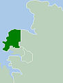
 Darwin city2LGA.png 250 × 327; 13 KB
-
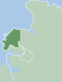
 Darwin cityLGA.JPG 250 × 327; 15 KB
-
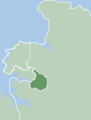
 DarwinLGA.gif 250 × 329; 6 KB
-
 Litchfield Shire LGA.gif 248 × 329; 13 KB
-
 LitchfieldLGA.gif 250 × 329; 6 KB
-
 Map of the Wards and Suburbs of Darwin, Northern Territory.png 3,060 × 3,375; 1.71 MB
-
 Map of the Wards and Suburbs of Darwin, Northern Territory.svg 1,469 × 1,620; 1.54 MB
-
 Palmerston City LGA.gif 248 × 329; 13 KB
-
 PalmerstonLGA.gif 250 × 329; 6 KB


