Category:Maps of maritime boundary between Peru and Chile
Media in category "Maps of maritime boundary between Peru and Chile"
The following 22 files are in this category, out of 22 total.
-
 Chile-Perú, Punto Concordia.jpg 918 × 882; 132 KB
-
 Chilean–Peruvian maritime boundary.JPG 3,944 × 2,608; 458 KB
-
 Comision-mixta-de-limites-peruano-chilena-1992.jpg 428 × 507; 67 KB
-
 Concordia-1973-mapa-arica-carta-nautica-chilena-101.jpg 693 × 487; 46 KB
-
 Delimitación entre Chile y el Perú 3.png 401 × 400; 23 KB
-
 Delimitación marítima entre Chile y el Perú 1.png 400 × 400; 43 KB
-
 Delimitación marítima entre Chile y el Perú 2.png 401 × 400; 32 KB
-
 ICJ Peru Chile judgment map1.png 2,116 × 2,472; 280 KB
-
 ICJ Peru Chile judgment map2.png 3,041 × 2,178; 437 KB
-
 ICJ Peru Chile judgment map3.png 3,000 × 2,176; 502 KB
-
 ICJ Peru Chile judgment map4 (svg version).svg 3,036 × 2,176; 2.19 MB
-
 ICJ Peru Chile judgment map4.png 3,036 × 2,176; 392 KB
-
 Image-Delimitación marítima entre Chile y el Perú 2.png 400 × 400; 30 KB
-
 Map of Chilean–Peruvian maritime dispute.JPG 4,408 × 2,608; 491 KB
-
 Map of Chilean–Peruvian maritime dispute.PNG 1,275 × 736; 335 KB
-
 Mapa de la frontera marítima Chile-Perú.svg 894 × 683; 165 KB
-
 Mapa enrique brieba concordia.jpg 586 × 822; 33 KB
-
-
 Mapa-oficial-de-arica-1966.jpg 496 × 537; 47 KB
-
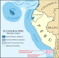
 Maritime Claims of Ecuador and Peru.svg 1,864 × 1,819; 373 KB
-
 Maritime Claims of Peru and Ecuador.svg 1,864 × 1,819; 660 KB
-
 Punto-concordia-mapa-1941-instituo-geografico-militar-chile.jpg 945 × 574; 236 KB


.svg)


