Category:Maps of municipalities in the canton of Fribourg to 2020
Media in category "Maps of municipalities in the canton of Fribourg to 2020"
The following 6 files are in this category, out of 6 total.
-
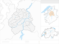
 Karte Bezirk Broye 2017 blank.png 2,066 × 1,505; 535 KB
-
 Karte Bezirk Broye 2017.png 2,066 × 1,505; 651 KB
-
 Karte Bezirk Saane 2020 blank.png 2,066 × 1,532; 578 KB
-
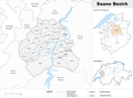 Karte Bezirk Saane 2020.png 2,066 × 1,532; 694 KB
-
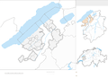
 Karte Bezirk Sense 2017 blank.png 2,066 × 1,722; 531 KB
-
 Karte Bezirk Sense 2017.png 2,066 × 1,722; 646 KB


