Category:Maps of municipalities in the canton of Valais to 2016
Media in category "Maps of municipalities in the canton of Valais to 2016"
The following 8 files are in this category, out of 8 total.
-
 Karte Bezirk Goms 2009 blank.png 2,066 × 1,358; 520 KB
-
 Karte Bezirk Goms 2009.png 2,066 × 1,357; 695 KB
-
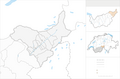
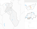
 Karte Bezirk Hérens 2011 blank.png 1,771 × 1,596; 528 KB
-
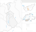
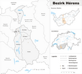 Karte Bezirk Hérens 2011.png 2,066 × 1,861; 816 KB
-
 Karte Bezirk Sierre 2009 blank.png 2,066 × 1,613; 605 KB
-
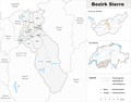 Karte Bezirk Sierre 2009.png 2,066 × 1,613; 755 KB
-
 Karte Bezirk Sion 2013 blank.png 2,066 × 1,386; 456 KB
-
 Karte Bezirk Sion 2013.png 2,066 × 1,386; 584 KB


