Category:Maps of municipalities in the district of Laupen
Subcategories
This category has only the following subcategory.
Media in category "Maps of municipalities in the district of Laupen"
The following 11 files are in this category, out of 11 total.
-
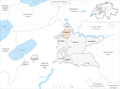
 Karte Gemeinde Clavaleyres 2007.png 1,476 × 1,095; 313 KB
-
 Karte Gemeinde Ferenbalm 2007.png 1,476 × 1,095; 314 KB
-
 Karte Gemeinde Frauenkappelen 2007.png 1,476 × 1,095; 314 KB
-
 Karte Gemeinde Golaten 2007.png 1,476 × 1,095; 313 KB
-
 Karte Gemeinde Gurbrü 2007.png 1,476 × 1,095; 313 KB
-
 Karte Gemeinde Kriechenwil 2007.png 1,476 × 1,095; 314 KB
-
 Karte Gemeinde Laupen 2007.png 1,476 × 1,095; 314 KB
-
 Karte Gemeinde Mühleberg 2007.png 1,476 × 1,095; 315 KB
-
 Karte Gemeinde Münchenwiler 2007.png 1,476 × 1,095; 313 KB
-
 Karte Gemeinde Neuenegg 2007.png 1,476 × 1,095; 314 KB
-
 Karte Gemeinde Wileroltigen 2007.png 1,476 × 1,095; 313 KB


