Category:Maps of municipalities of San Miguel Department
Media in category "Maps of municipalities of San Miguel Department"
The following 22 files are in this category, out of 22 total.
-
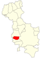
 Carolina.png 1,500 × 2,000; 125 KB
-
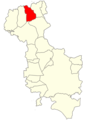
 Chapeltique.png 1,500 × 2,000; 125 KB
-
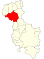
 Chinameca.png 1,500 × 2,000; 125 KB
-
 Chirilagua.png 1,500 × 2,000; 124 KB
-
 Ciudad Barrios.png 1,500 × 2,000; 125 KB
-
 Comacaran.png 1,500 × 2,000; 125 KB
-
 Departamento de San Miguel.svg 512 × 395; 37 KB
-
 El Transito.png 1,500 × 2,000; 125 KB
-
 Lolotique.png 1,500 × 2,000; 125 KB
-
 Moncagua.png 1,500 × 2,000; 125 KB
-
 Nueva Guadalupe.png 1,500 × 2,000; 125 KB
-
 Nuevo Eden de San Juan.png 1,500 × 2,000; 125 KB
-
 Quelepa.png 1,500 × 2,000; 125 KB
-
 San Antonio.png 1,500 × 2,000; 125 KB
-
 San Gerardo.png 1,500 × 2,000; 125 KB
-
 San Jorge ES.png 1,500 × 2,000; 125 KB
-
 San Luis de la Reina.png 1,500 × 2,000; 125 KB
-
 San Miguel Municipio v.2.png 1,500 × 2,000; 127 KB
-
 San Miguel Municipio.png 340 × 480; 8 KB
-
 San Rafael Oriente.png 1,500 × 2,000; 125 KB
-
 Sesori.png 1,500 × 2,000; 125 KB
-
 Uluazapa.png 1,500 × 2,000; 125 KB


