Category:Maps of municipalities of Switzerland to 1960
Media in category "Maps of municipalities of Switzerland to 1960"
The following 14 files are in this category, out of 14 total.
-
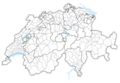 Karte Bezirke und Kreise der Schweiz 1937.png 4,133 × 2,848; 2.63 MB
-
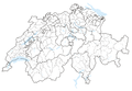 Karte Bezirke und Kreise der Schweiz 1960.png 4,133 × 2,848; 2.22 MB
-
 Karte Bezirke und Kreise der Schweiz farbig 1937.png 4,133 × 2,848; 3.26 MB
-
 Karte Bezirke und Kreise der Schweiz farbig 1960.png 4,133 × 2,848; 2.87 MB
-
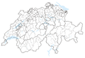
 Karte Bezirke der Schweiz 1937.png 4,133 × 2,848; 2.48 MB
-
 Karte Bezirke der Schweiz 1960.png 4,133 × 2,848; 2.06 MB
-
 Karte Bezirke der Schweiz farbig 1937.png 4,133 × 2,848; 2.93 MB
-
 Karte Bezirke der Schweiz farbig 1960.png 4,133 × 2,848; 2.5 MB
-
 Karte Gemeinden des Kantons Solothurn 1850.png 2,952 × 2,703; 1.68 MB
-
 Karte Gemeinden des Kantons Solothurn 1939.png 2,952 × 2,701; 1.08 MB
-
 Karte Gemeinden des Kantons Solothurn farbig 1939.png 2,952 × 2,703; 2.03 MB
-
 Karte Gemeinden des Kantons Waadt 1852.png 2,952 × 2,931; 1.97 MB
-
 Karte Gemeinden des Kantons Waadt 1959.png 2,952 × 2,954; 1.51 MB
-
 Karte Gemeinden des Kantons Waadt farbig 1959.png 2,952 × 2,923; 2.52 MB


