Category:Maps of municipalities of Switzerland to 1971
Media in category "Maps of municipalities of Switzerland to 1971"
The following 12 files are in this category, out of 12 total.
-
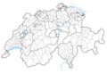
 Karte Bezirke der Schweiz farbig 1967.png 4,133 × 2,848; 3.01 MB
-
 Karte Bezirke und Kreise der Schweiz 1967.png 4,133 × 2,848; 2.66 MB
-
 Karte Bezirke der Schweiz 1967.png 4,133 × 2,738; 2.58 MB
-
 Karte Bezirke und Kreise der Schweiz farbig 1967.png 4,133 × 2,848; 3.3 MB
-
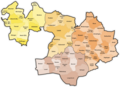
 Karte Gemeinden des Kantons Basel-Landschaft 1882.png 2,952 × 2,137; 1.06 MB
-
 Karte Gemeinden des Kantons Basel-Landschaft farbig 1882.png 2,952 × 2,137; 1.3 MB
-
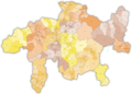
 Karte Gemeinden des Kantons Graubünden 1970.png 3,837 × 2,744; 1.68 MB
-
 Karte Gemeinden des Kantons Graubünden farbig 1970.png 3,836 × 2,751; 2.45 MB
-
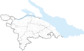 Karte Gemeinden des Kantons Thurgau 1969.png 2,952 × 1,786; 841 KB
-
 Karte Gemeinden des Kantons Thurgau 1971.png 2,952 × 1,786; 839 KB
-
 Karte Gemeinden des Kantons Thurgau farbig 1969.png 2,952 × 1,786; 1.12 MB
-
 Karte Gemeinden des Kantons Thurgau farbig 1971.png 2,952 × 1,786; 1.12 MB


