Category:Maps of municipalities of Switzerland to 1994
Media in category "Maps of municipalities of Switzerland to 1994"
The following 12 files are in this category, out of 12 total.
-
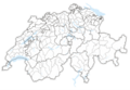
 Karte Bezirke und Kreise der Schweiz 1994.png 4,133 × 2,848; 2.67 MB
-
 Karte Bezirke und Kreise der Schweiz farbig 1994.png 4,133 × 2,848; 3.3 MB
-
 Karte Bezirke der Schweiz 1994.png 4,133 × 2,848; 2.51 MB
-
 Karte Bezirke der Schweiz farbig 1994.png 4,133 × 2,848; 2.97 MB
-
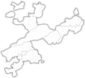
 Karte Gemeinden des Kantons Freiburg 1993.png 2,952 × 3,304; 2 MB
-
 Karte Gemeinden des Kantons Freiburg farbig 1993.png 2,952 × 3,304; 2.66 MB
-
 Karte Gemeinden des Kantons Solothurn 1994.png 2,952 × 2,703; 1.68 MB
-
 Karte Gemeinden des Kantons Solothurn farbig 1994.png 2,952 × 2,703; 2.01 MB
-
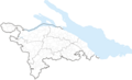
 Karte Gemeinden des Kantons Tessin 1976.png 1,771 × 2,926; 1.2 MB
-
 Karte Gemeinden des Kantons Tessin farbig 1976.png 1,771 × 2,926; 1.51 MB
-
 Karte Gemeinden des Kantons Thurgau 1994.png 2,952 × 1,786; 823 KB
-
 Karte Gemeinden des Kantons Thurgau farbig 1994.png 2,952 × 1,786; 1.08 MB


