Category:Maps of national parks of Colombia
Media in category "Maps of national parks of Colombia"
The following 20 files are in this category, out of 20 total.
-
 Andino regions map.svg 493 × 882; 7.04 MB
-
 Colombia regions map.svg 460 × 559; 1.59 MB
-
 Colombian Amazonia regions map.svg 970 × 793; 4.41 MB
-
 Colombian Islands regions map.svg 650 × 1,293; 1.15 MB
-
 Costa Norte regions map.svg 587 × 530; 5.84 MB
-
 Mapa Base PNR Sisavita.jpg 1,434 × 1,239; 1.47 MB
-
 Mapa Complejo de Lagunas Arboledas-Salazar-Cachira Paramo Santurban.jpg 3,509 × 2,478; 4.94 MB
-
 Mapa de Colombia (parques naturales).png 1,269 × 1,193; 71 KB
-
 Mapa de Colombia (parques naturales).svg 1,766 × 2,128; 2.64 MB
-
 Mapa Locaclizador.png 460 × 559; 63 KB
-
 Orinoquía regions map.svg 701 × 526; 3.17 MB
-
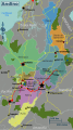
 Parque Nacional Natural Chingaza map de.png 1,191 × 1,048; 2.13 MB
-
 Parque Nacional Natural Chingaza map es.png 1,191 × 1,048; 2.13 MB
-
 Parque Nacional Natural Chiribiquete map de.png 1,500 × 1,490; 3.38 MB
-
 Parque Nacional Natural Chiribiquete map en.png 1,500 × 1,490; 3.37 MB
-
 Parque Nacional Natural Chiribiquete map es.png 1,500 × 1,490; 3.38 MB
-
 Parque Nacional Natural Corales del Rosario y San Bernardo.svg 705 × 1,132; 58 KB
-
 Reserva de La Macarena.png 849 × 600; 716 KB
-
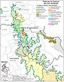 Sistemas de Paramos del Gran Santander - Santurban, Almorzadero, Tamá.jpg 2,550 × 3,300; 3.53 MB
-
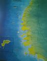 Tayrona Park Map.jpg 3,209 × 4,144; 5.84 MB


.png)
.svg)


