Category:Maps of neighborhoods in Tokyo
Media in category "Maps of neighborhoods in Tokyo"
The following 11 files are in this category, out of 11 total.
-
 Chiyodacity-townmap1.png 1,900 × 1,900; 93 KB
-
 Ginza-townmap-kyobashiward.png 1,500 × 1,800; 68 KB
-
 Kanda-townmap1.png 2,529 × 1,869; 255 KB
-
 Shinjukucity-townmap1.png 2,321 × 2,117; 328 KB
-
 Sotokanda-townmap1.png 1,620 × 1,000; 41 KB
-
 中央区(東京都)住居表示対照図1.png 1,300 × 1,300; 80 KB
-
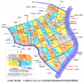
 中央区(東京都)住居表示対照図2.png 1,500 × 1,800; 108 KB
-
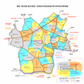
 中央区(東京都)住居表示対照図3.png 1,500 × 1,900; 101 KB
-
 中野区中野の町名略図.png 1,785 × 966; 117 KB
-
 青山地区(東京都港区)住居表示対照図.png 1,400 × 1,600; 50 KB
-
 麻布地区(東京都港区)住居表示対照図.png 1,400 × 1,400; 67 KB


%E4%BD%8F%E5%B1%85%E8%A1%A8%E7%A4%BA%E5%AF%BE%E7%85%A7%E5%9B%B31.png)
%E4%BD%8F%E5%B1%85%E8%A1%A8%E7%A4%BA%E5%AF%BE%E7%85%A7%E5%9B%B32.png)
%E4%BD%8F%E5%B1%85%E8%A1%A8%E7%A4%BA%E5%AF%BE%E7%85%A7%E5%9B%B33.png)

%E4%BD%8F%E5%B1%85%E8%A1%A8%E7%A4%BA%E5%AF%BE%E7%85%A7%E5%9B%B3.png)
%E4%BD%8F%E5%B1%85%E8%A1%A8%E7%A4%BA%E5%AF%BE%E7%85%A7%E5%9B%B3.png)