Category:Maps of neighbourhoods in Cruz de Humilladero
Districts of Málaga: Bailén-Miraflores · Campanillas · Carretera de Cádiz · Centro · Ciudad Jardín · Cruz de Humilladero · Este · Palma-Palmilla · Puerto de la Torre ·
Media in category "Maps of neighbourhoods in Cruz de Humilladero"
The following 33 files are in this category, out of 33 total.
-
 4 de Diciembre locator map.svg 1,863 × 1,252; 109 KB
-
 Camino de Antequera locator map.svg 1,863 × 1,252; 94 KB
-
 Carranque locator map.svg 1,863 × 1,252; 87 KB
-
 Cortijo Alto locator map.svg 1,863 × 1,252; 127 KB
-
 Cortijo de Torres locator map.svg 1,863 × 1,252; 125 KB
-
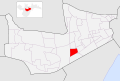
 Cruz del Humilladero locator map.svg 1,863 × 1,252; 107 KB
-
 El Duende locator map.svg 1,863 × 1,252; 124 KB
-
 Haza Cuevas locator map.svg 1,863 × 1,252; 92 KB
-
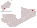
 Intelhorce locator map.svg 1,863 × 1,252; 133 KB
-
 La Asunción locator map.svg 1,863 × 1,252; 112 KB
-
 La Barriguilla locator map.svg 1,863 × 1,252; 119 KB
-
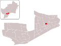
 La Unión locator map.svg 1,863 × 1,252; 103 KB
-
 LocalizacionLaUnion.svg 3,264 × 2,448; 784 KB
-
 Localización4deDiciembre.svg 3,264 × 2,448; 770 KB
-
 LocalizaciónArroyodelCuarto.svg 3,264 × 2,448; 800 KB
-
 LocalizaciónExplanadaEstación.svg 3,264 × 2,448; 791 KB
-
 LocalizaciónHazaCuevas.svg 3,264 × 2,448; 805 KB
-
 LocalizaciónLaAurora.svg 3,264 × 2,448; 797 KB
-
 LocalizaciónLosTilos.svg 3,264 × 2,448; 789 KB
-
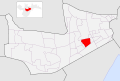
 Los Prados locator map.svg 1,863 × 1,252; 131 KB
-
 Los Tilos locator map.svg 1,863 × 1,252; 102 KB
-
 Nuestra Señora del Carmen locator map.svg 1,863 × 1,252; 112 KB
-
 Núcleo General Franco locator map.svg 1,863 × 1,252; 111 KB
-
 Polígono Carretera de Cártama locator map.svg 1,863 × 1,252; 117 KB
-
 Portada Alta locator map.svg 1,863 × 1,252; 95 KB
-
 San José del Viso locator map.svg 1,863 × 1,252; 134 KB
-
 San Rafael locator map.svg 1,863 × 1,252; 120 KB
-
 Santa Cristina locator map.svg 1,863 × 1,252; 123 KB
-
 Santa Julia locator map.svg 1,863 × 1,252; 104 KB
-
 Santa Marta locator map.svg 1,863 × 1,252; 103 KB
-
 Sánchez Blanca locator map.svg 1,863 × 1,252; 135 KB
-
 Teatinos locator map.svg 1,863 × 1,252; 117 KB
-
 Tiro de Pichón locator map.svg 1,863 × 1,252; 122 KB


