Category:Maps of proposed US States
Media in category "Maps of proposed US States"
The following 40 files are in this category, out of 40 total.
-
 1850 Vereinigte Staaten von Nord America und Mexico Meyer Deseret Detail 3.JPG 2,592 × 1,944; 1.26 MB
-
 8FranklinCounties.png 1,340 × 1,029; 210 KB
-
 Absaroka map from contemporary newspaper.jpg 1,340 × 1,101; 224 KB
-
 Absaroka outline.png 800 × 632; 55 KB
-
 Cal3 Map.png 511 × 857; 66 KB
-
 Cal3 map.svg 621 × 733; 255 KB
-
 CaliFOURnia map.svg 621 × 733; 255 KB
-

-
 State of Deseret, vector image - 2011.svg 371 × 398; 19 KB
-
 State of Deseret, vector image cropped - 2011.svg 320 × 310; 29 KB
-
 Utah Territory with Deseret Border, vector image - 2011.svg 320 × 310; 29 KB
-
 Wpdms deseret utah territory legend.png 300 × 360; 67 KB
-
 Forgottonia.png 167 × 300; 27 KB
-
 Map of Tennessee highlighting Former State of Franklin.png 1,024 × 251; 84 KB
-
 LINCOLN (TEXAS).png 440 × 314; 17 KB
-
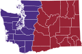
 LINCOLN (WASHINGTON e IDAHO).png 587 × 307; 21 KB
-
 Lincoln in TX.png 450 × 316; 10 KB
-
 Lincoln in United States.svg 3,440 × 2,199; 678 KB
-
 Lincoln in WA and ID.png 450 × 316; 11 KB
-
 Lincoln in WA and ID.svg 280 × 280; 383 KB
-
 Map of Alabama highlighting the 'Republic of Winston'.svg 3,379 × 5,346; 94 KB
-
 Map of Liberty.svg 1,781 × 1,159; 231 KB
-
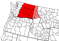
 Map of the State of Superior (proposed).svg 238 × 206; 79 KB
-
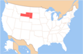 Map of USA AB.png 286 × 186; 32 KB
-
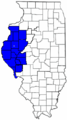
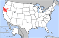 Map of usa highlighting jefferson.png 280 × 183; 42 KB
-
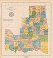
 Nc51map.png 641 × 753; 82 KB
-
 New California map.svg 641 × 753; 272 KB
-
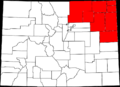 North Colorado.png 1,000 × 724; 108 KB
-
 Pacific Islands as 51st state of the US.jpg 715 × 628; 102 KB
-
 Proposed state of kanawha.jpg 750 × 500; 105 KB
-
 IndianTerritory.jpg 1,000 × 1,061; 233 KB
-
 Sequoyah map.jpg 4,390 × 4,820; 9.65 MB
-
 Six Californias.png 596 × 676; 13 KB
-
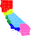 Six Californias.svg 621 × 733; 255 KB
-
 State of Jefferson.png 180 × 289; 30 KB
-
 State of Sequoyah LOC 2013592417.jpg 4,749 × 5,267; 3.46 MB
-
 State of Sequoyah LOC 2013592417.tif 4,749 × 5,267; 71.56 MB
-
 Superior-Proposed-State-Expanded.png 345 × 300; 52 KB
-
 US-McD.Terr.(1961).svg 26 × 22; 18 KB
-
 Westsylvaniamap.png 1,000 × 1,000; 1.7 MB


.png)
.png)


.svg)


.svg)
