Category:Maps of protected areas of Bhutan
Media in category "Maps of protected areas of Bhutan"
The following 14 files are in this category, out of 14 total.
-
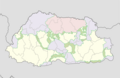
 Bhutan protected areas location map.png 1,000 × 653; 221 KB
-
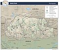
 2015 map detail, Bhutan Physiography (cropped).jpg 2,500 × 1,440; 699 KB
-
 Bhutan Physiography.jpg 2,632 × 2,215; 948 KB
-
 Bumdeling protected area location map.png 1,000 × 653; 220 KB
-
 Jigme Dorji protected area location map.png 1,000 × 653; 219 KB
-
 Jigme Singye protected area location map.png 1,000 × 653; 220 KB
-
 Khaling protected area location map.png 1,000 × 653; 221 KB
-
 Map showing Jigme Singye Wangchuck National Park.PNG 960 × 661; 185 KB
-
 Phibsoo protected area location map.png 1,000 × 653; 220 KB
-
 Royal Manas protected area location map.png 1,000 × 653; 220 KB
-
 Sakteng protected area location map.png 1,000 × 653; 221 KB
-
 Thrumshingla protected area location map.png 1,000 × 653; 220 KB
-
 Torsa protected area location map.png 1,000 × 653; 221 KB
-
 Wangchuck Centennial protected area location map.png 1,000 × 653; 219 KB

.jpg)


