Category:Maps of provinces of Zambia till 2016
Media in category "Maps of provinces of Zambia till 2016"
The following 6 files are in this category, out of 6 total.
-
 Zambia Central Province Districts.svg 900 × 900; 1.83 MB
-
 Zambia Copperbelt Province Districts.svg 900 × 900; 804 KB
-
 Zambia Eastern Province Districts.svg 900 × 900; 933 KB
-
 Zambia Luapula Province Districts.svg 900 × 900; 899 KB
-
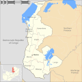
 Zambia Lusaka Province Districts.svg 900 × 900; 917 KB
-
 Zambia Northern Province Districts.svg 900 × 900; 926 KB


