Category:Maps of states of Mexico
Subcategories
This category has the following 5 subcategories, out of 5 total.
Media in category "Maps of states of Mexico"
The following 9 files are in this category, out of 9 total.
-
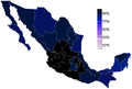
 2012 Density Map.png 1,995 × 1,281; 119 KB
-
 Mapa de los estados de México (sin etiquetas).png 2,560 × 1,673; 549 KB
-
 Mapa estatal de México (sin etiquetas).jpg 800 × 538; 55 KB
-
 Mexican states by population 2012.png 1,850 × 1,251; 103 KB
-
 Mexico - DPLA - 9e7fe0d54ead2329ce89d3411e3c627d.jpg 3,276 × 2,554; 1.34 MB
-
 Mexico - DPLA - be0e438da1097aaa77d8f4cb1715abaf.jpg 3,278 × 2,560; 1.62 MB
-
 Mexico Base Map.png 1,104 × 697; 450 KB
-
 Presencia de Dymsa en México.png 938 × 907; 139 KB
-
 Religious Belief in Mexico-states.png 1,850 × 1,251; 90 KB

.png)
.jpg)


