Category:Maps of subdivisions of South Africa
Countries of Africa: Algeria · Benin · Botswana · Burkina Faso · Cameroon · Cape Verde · Chad · Republic of the Congo · Equatorial Guinea · Ethiopia · Gabon · Ghana · Guinea · Ivory Coast · Kenya · Lesotho · Liberia · Madagascar · Morocco · Mozambique · Namibia · Niger · Rwanda · Sierra Leone · Somalia · South Africa · South Sudan · Sudan · Tanzania · Togo · Uganda · Zambia · Zimbabwe
Limited recognition: Ambazonia
Limited recognition: Ambazonia
Subcategories
This category has the following 3 subcategories, out of 3 total.
M
P
Media in category "Maps of subdivisions of South Africa"
The following 5 files are in this category, out of 5 total.
-
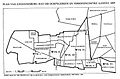 Johannesburg 1897.jpg 2,227 × 1,464; 331 KB
-
 Magisterial Districts.png 3,024 × 2,728; 242 KB
-
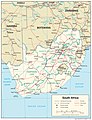 South Africa Administrative Divisions.jpg 2,000 × 2,614; 1.56 MB
-
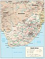 South Africa Physiography.jpg 2,000 × 2,614; 1.68 MB
-
 South Africa Transportation.jpg 2,000 × 2,614; 1.55 MB


