Category:Maps of temporarily occupied territories of Ukraine
Media in category "Maps of temporarily occupied territories of Ukraine"
The following 11 files are in this category, out of 11 total.
-
 2014 Russo-ukrainian-conflict map.svg 4,126 × 4,480; 2.75 MB
-
 Russian occupation of North Ukraine.png 371 × 289; 56 KB
-
 Russian Occupation of Zhytomyr Oblast.png 800 × 1,037; 149 KB
-
 Russian occupied Chernihiv Oblast (2022).jpg 385 × 433; 24 KB
-
 Russian occupied Kyiv Oblast (2022).jpg 400 × 400; 18 KB
-
 Russian occupied Zhytomyr Oblast (2022).jpg 357 × 486; 25 KB
-
 Skirmishes near hadiach.png 1,180 × 714; 177 KB
-
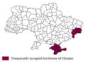 Temporarily occupied territories of Ukraine.png 569 × 460; 37 KB
-
 Ukraine under russian occupation.svg 3,780 × 2,540; 1.85 MB
-
 Временно оккупованная территория Украины.png 569 × 460; 30 KB
-
 Тимчасово окупована територія України.png 569 × 460; 37 KB


.jpg)
.jpg)
.jpg)


