Category:Maps of the Alavid dynasty
Media in category "Maps of the Alavid dynasty"
The following 14 files are in this category, out of 14 total.
-
 Alavian-persian.svg 1,040 × 480; 35 KB
-
 Alavids-map-es.svg 1,040 × 480; 59 KB
-
 Alavids-map.png 1,040 × 480; 126 KB
-
 Alavids-map.svg 1,040 × 480; 37 KB
-
 Alavids-MZN.svg 1,040 × 480; 55 KB
-
 Ancient Tabaristan highlighted.png 449 × 345; 347 KB
-
 Arabische Eroberung 2.jpg 4,496 × 2,841; 3.36 MB
-
 EditedStattering.png 1,199 × 584; 34 KB
-
 Fragmentation of the Abbasid Caliphate-ar.jpg 1,344 × 903; 348 KB
-
 Fragmentation of the Abbasid Caliphate.jpg 1,344 × 903; 311 KB
-
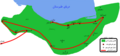 Mofleh war in tabaristan.png 780 × 366; 25 KB
-
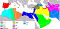
 Muslim lands at the ends of the 11th and 12th centuries.jpg 4,307 × 2,837; 3.51 MB
-
 Samanid and Alavid - 316.svg 1,114 × 538; 636 KB
-
 The Caliphate (632 - 945).jpg 4,415 × 2,847; 3.47 MB


.jpg)