Category:Maps of the Antiquity of Bretagne
Media in category "Maps of the Antiquity of Bretagne"
The following 19 files are in this category, out of 19 total.
-

-

-
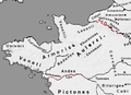 Armorica.png 395 × 286; 32 KB
-
 Bataille Morbihan -56 he.png 1,842 × 1,125; 84 KB
-
 Bretagne-Pays de la Loire - Empire romain - Capitale de cités et cités.svg 3,479 × 1,869; 130 KB
-
 C voies romaines bretagne.jpg 1,000 × 589; 379 KB
-
 Cap Sizun Implantations modernes.jpg 6,233 × 2,230; 1.39 MB
-
 Carte de l'aire culturelle des riedones.png 4,678 × 3,308; 2.59 MB
-
 Carte de l'Armorique.png 766 × 899; 186 KB
-
 Carte des limites de la ville antique de Condate.png 3,308 × 4,678; 1.81 MB
-
 Celtic Tribes in Brittany-es.svg 480 × 316; 63 KB
-
 Celtic Tribes in Brittany.svg 480 × 316; 42 KB
-
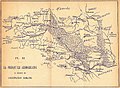
 Civitas Aquilonia et ses environs.jpg 675 × 1,073; 375 KB
-
 Kartenn Galianed he.jpg 854 × 562; 127 KB
-
 Kartenn Galianed.jpg 854 × 562; 117 KB
-
 Kerviler-bretagne-planche3.jpg 1,559 × 1,142; 416 KB
-
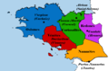
 Peuples celtes en armorique.jpg 800 × 526; 165 KB
-
 Peuples celtes en armorique.png 800 × 526; 62 KB
-
 Plan des peuples gaulois.svg 888 × 669; 19 KB
.jpg)
%27_(11166994984).jpg)


