Category:Maps of the Arabian Sea
Subcategories
This category has the following 4 subcategories, out of 4 total.
G
H
P
Media in category "Maps of the Arabian Sea"
The following 52 files are in this category, out of 52 total.
-
-
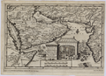
 Accuratissima et Maxima Totius Turcici Imperii Tabula.jpg 8,820 × 7,380; 8.33 MB
-
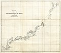
 1773 map of the Arabian Sea by Schley.jpg 2,416 × 3,055; 2.75 MB
-
 20200211 NP EMASoH Brief map 2 cleaned - Copy.jpg 3,000 × 1,916; 1.86 MB
-
-

-
 Admiralty Chart Catalogue 1967 Page 051 Index H1.jpg 8,567 × 6,905; 8.67 MB
-
 Admiralty Chart No 1012 Arabian Sea, Published 1961.jpg 17,656 × 11,287; 63.34 MB
-
 Admiralty Chart No 1487 Approaches to Bombay, Published 1964.jpg 16,388 × 11,241; 34.53 MB
-
 AMS Trivandrum (cropped) now Thiruvananthapuram costal region.jpg 862 × 1,149; 305 KB
-
 AMS Trivandrum.jpg 5,000 × 3,819; 4.27 MB
-
 Araabia meri.png 797 × 753; 191 KB
-
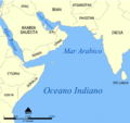
 Arabian Sea (PSF).png 1,996 × 1,444; 538 KB
-
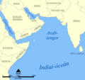
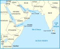
 Arabian Sea in its region.svg 500 × 281; 4.83 MB
-
 Arabian Sea map (cropped).png 500 × 473; 116 KB
-
 Arabian Sea map bs.svg 674 × 636; 288 KB
-
 Arabian Sea map de.png 800 × 757; 183 KB
-
 Arabian Sea map He.png 797 × 753; 127 KB
-
 Arabian Sea map hr.svg 674 × 636; 279 KB
-
 Arabian Sea map hu.png 797 × 753; 166 KB
-
 Arabian Sea map io.png 797 × 753; 139 KB
-
 Arabian Sea map it.png 797 × 753; 177 KB
-
 Arabian Sea map ku.png 797 × 753; 170 KB
-
 Arabian Sea map ku.svg 797 × 753; 151 KB
-
 Arabian Sea map lb.png 800 × 757; 253 KB
-
 Arabian Sea map mk.png 800 × 757; 134 KB
-
 Arabian Sea map mk.svg 674 × 636; 276 KB
-
 Arabian Sea map uk.png 797 × 753; 136 KB
-
 Arabian Sea map Ur Names.svg 3,320 × 3,137; 408 KB
-
 Arabian Sea map-A.png 800 × 757; 126 KB
-
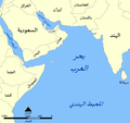 Arabian Sea map-ar.png 797 × 753; 130 KB
-
 Arabian Sea map-br.png 800 × 757; 167 KB
-
 Arabian Sea map.png 797 × 753; 147 KB
-
 Arapsko more.png 800 × 757; 170 KB
-
 Coastal India topographical.jpg 622 × 345; 49 KB
-
 D155- Mer Arabique -liv2-ch12.png 1,438 × 1,690; 439 KB
-
 French Somaliland 1922.jpg 1,665 × 1,081; 494 KB
-
 GolfvonAdenKartevonDanielPresberger.png 800 × 668; 145 KB
-
 He Arabian Sea map.png 634 × 600; 95 KB
-
 IslandsofBombay1893.jpg 521 × 800; 102 KB
-
 Locatie Arabische Zee.PNG 652 × 468; 16 KB
-
 Oman Sea map-fr.svg 492 × 394; 376 KB
-
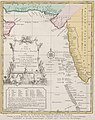
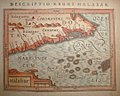
 Portuguese Arabia V20.png 800 × 777; 166 KB
-
 Southern Red Sea Arabian Sea 1922.jpg 2,068 × 2,801; 1.5 MB
-
-
-
-

-

-

-

-
 Umman Denizi.png 634 × 600; 112 KB
%27_(11023998214).jpg)


_now_Thiruvananthapuram_costal_region.jpg)


.png)

.png)


