Category:Maps of the Austrian Kingdom of Illyria
Media in category "Maps of the Austrian Kingdom of Illyria"
The following 18 files are in this category, out of 18 total.
-
 Austrian kingdom of illyria.png 700 × 908; 72 KB
-
 Flag map of the Kingdom of Illyria.png 612 × 612; 92 KB
-

-
 General-Karte des Königreichs Illyrien nebst dem Königlich Ungarischen Littorale 1843.jpg 10,338 × 13,256; 113.39 MB
-
 Ilirsko kraljestvo po ustanovitvenem aktu 1816.PNG 426 × 434; 40 KB
-
 Ilirsko kraljestvo-idejna zasnova.PNG 441 × 435; 39 KB
-
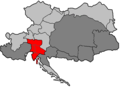 Illyrien Donaumonarchie.png 702 × 510; 11 KB
-
 Karte von Tirol, Steyermark und Illyrien 1832.jpg 7,733 × 5,848; 8 MB
-
-
 Königreich Illyrien und Herzogthum Steyermark 1819.jpg 25,281 × 27,029; 96.29 MB
-
 Königreich Illyrien, Gouvernement Laibach Charte der Kreise 1836.jpg 10,292 × 8,608; 10.04 MB
-
 Königreich Illyrien. Das Gebiet der Stadt Triest in grösserem Maasse.jpg 2,977 × 2,351; 841 KB
-
 Königreich Illyrien.jpg 4,509 × 5,430; 6.94 MB
-
 Mapa do Reino da Ilíria 1822-1849.png 900 × 1,167; 451 KB
-
 Neueste Specialkarte von Krain nach der dermaligen Eintheilung in Bezirke 1831.jpg 9,294 × 7,224; 13.37 MB
-
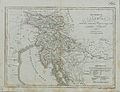
 Riedl - Koenigreiche Illyrien.jpg 7,150 × 5,808; 39.43 MB
-
 Upravni zemljevid Ilirskega kraljestva leta 1817.jpg 7,365 × 9,760; 9.56 MB
-
 Upravni zemljevid Kranjske leta 1836.jpg 800 × 669; 155 KB


.jpg)


