Category:Maps of the Bashkir Soviet Republic
Media in category "Maps of the Bashkir Soviet Republic"
The following 30 files are in this category, out of 30 total.
-
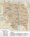
 Bashkiriya-tatarstan-1920.jpg 4,507 × 3,039; 3.54 MB
-
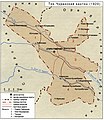
 BURZYAN TANGAUR kanton.jpg 768 × 957; 480 KB
-
 DUVAN KUCHIN KANTON.jpg 1,000 × 1,511; 1.15 MB
-
 KIPSAK JETIR kanton.jpg 1,920 × 1,670; 237 KB
-
 KUDEISK kanton.jpg 750 × 698; 328 KB
-
 TABYNSKI kanton.jpg 900 × 989; 858 KB
-
 TOK CHURANSKI kanton.jpg 700 × 809; 404 KB
-
 YALANSKI kanton.jpg 750 × 452; 257 KB
-
 YURMATY kanton.jpg 1,800 × 1,307; 356 KB
-
 Карта Башкирской АССР на конец сентября 1919 года.svg 2,457 × 2,070; 184 KB
-
 Карта Башкирской АССР на начало июля 1919 года — Дуванский кантон.svg 2,457 × 2,070; 164 KB
-
 Карта Башкирской АССР на начало июля 1919 года — Кущинский кантон.svg 2,457 × 2,070; 164 KB
-
 Карта Башкирской АССР на начало июля 1919 года.svg 2,457 × 2,070; 181 KB
-
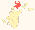
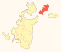 Карта Башкирской АССР на начало сентября 1919 года — Аргаяшский кантон.svg 2,457 × 2,070; 154 KB
-
 Карта Башкирской АССР на начало сентября 1919 года — Бурзян-Тангауровский кантон.svg 2,457 × 2,070; 154 KB
-
 Карта Башкирской АССР на начало сентября 1919 года — Джетировский кантон.svg 2,457 × 2,070; 154 KB
-
 Карта Башкирской АССР на начало сентября 1919 года — Дуван-Кущинский кантон.svg 2,457 × 2,070; 154 KB
-
 Карта Башкирской АССР на начало сентября 1919 года — Кипчакский кантон.svg 2,457 × 2,070; 154 KB
-
 Карта Башкирской АССР на начало сентября 1919 года — Кудейский кантон.svg 2,457 × 2,070; 154 KB
-
 Карта Башкирской АССР на начало сентября 1919 года — Табынский кантон.svg 2,457 × 2,070; 154 KB
-
 Карта Башкирской АССР на начало сентября 1919 года — Тамьян-Катайский кантон.svg 2,457 × 2,070; 154 KB
-
 Карта Башкирской АССР на начало сентября 1919 года — Ток-Чуранский кантон.svg 2,457 × 2,070; 154 KB
-
 Карта Башкирской АССР на начало сентября 1919 года — Усерганский кантон.svg 2,457 × 2,070; 154 KB
-
 Карта Башкирской АССР на начало сентября 1919 года — Юрматынский кантон.svg 2,457 × 2,070; 154 KB
-
 Карта Башкирской АССР на начало сентября 1919 года — Яланский кантон.svg 2,457 × 2,070; 154 KB
-
 Карта Башкирской АССР на начало сентября 1919 года.svg 2,457 × 2,070; 170 KB
-
 Карта Башкирской Советской Республики с ноябрь 1919 года.svg 2,457 × 2,070; 168 KB
-
 Кипчак-Джетировский кантон на карте БСР.svg 2,457 × 2,070; 168 KB
-
 Усерганский кантон (Малая Башкирия).png 1,200 × 1,216; 930 KB
-
 Юрматынский кантон на карте БСР.svg 2,457 × 2,070; 168 KB


.png)
