Category:Maps of the Bay of Bengal
Subcategories
This category has only the following subcategory.
O
- Old maps of the Bay of Bengal (27 F)
Media in category "Maps of the Bay of Bengal"
The following 20 files are in this category, out of 20 total.
-
 Bansec71.PNG 914 × 1,194; 193 KB
-
 Bay of Bengal (te).png 328 × 335; 176 KB
-
 Bay of Bengal location map simple.svg 370 × 383; 335 KB
-
 Bay of Bengal map 1800s.png 1,000 × 1,019; 204 KB
-
 Bay of Bengal map ast.svg 1,662 × 1,646; 514 KB
-
 Bay of Bengal map de.svg 1,662 × 1,646; 508 KB
-
 Bay of Bengal map es.svg 1,662 × 1,646; 515 KB
-
 Bay of Bengal map hindi.png 1,000 × 1,019; 216 KB
-
 Bay of Bengal map hr.svg 1,035 × 1,054; 244 KB
-
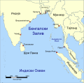
 Bay of Bengal map ka.png 1,000 × 1,019; 291 KB
-
 Bay of Bengal map ku.png 1,000 × 1,019; 268 KB
-
 Bay of Bengal map mk.svg 1,662 × 1,646; 637 KB
-
 Bay of Bengal map pl.svg 1,662 × 1,646; 508 KB
-
 Bay of Bengal map ta.svg 1,662 × 1,646; 511 KB
-
 Bay of Bengal map-br.png 1,000 × 1,019; 271 KB
-
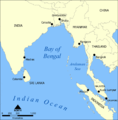 Bay of Bengal map.png 1,000 × 1,019; 342 KB
-
 Bengali laht.png 1,000 × 1,019; 273 KB
-
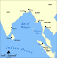
 Golfe-du-Bengale.png 1,145 × 806; 233 KB
-
 Location of Bright Armetis August 15 2006 accident.png 780 × 745; 189 KB
-
 বঙ্গোপসাগরের মানচিত্র.svg 1,662 × 1,646; 409 KB

.png)


