Category:Maps of the Bay of Fundy
Media in category "Maps of the Bay of Fundy"
The following 45 files are in this category, out of 45 total.
-
-

-

-
 Admiralty Chart No 1857 Bay of Fundy L'Etang (Letang) Harbour, Published 1848.jpg 8,105 × 6,114; 9.15 MB
-
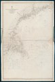
 Admiralty Chart No 2492 Bay of Fundy to Block Island, Published 1857.jpg 8,130 × 11,946; 7.64 MB
-
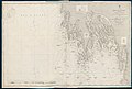 Admiralty Chart No 2537 Bay of Fundy East Coast Pubnico to Yarmouth, Published 1857.jpg 11,934 × 8,029; 15.39 MB
-
 Admiralty Chart No 2538 Bay of Fundy Yarmouth to Petit Passage, Published 1858.jpg 8,113 × 11,923; 10.69 MB
-
 Admiralty Chart No 2539 Bay of Fundy Grand Manan Island, Published1857.jpg 8,074 × 11,957; 7.15 MB
-
 Admiralty Chart No 2561 Bay of Fundy from Gulliver Hole to St Croix Bay, Published 1858.jpg 11,855 × 8,074; 13.54 MB
-
 Admiralty Chart No 2656 Bay of Fundy East Coast Bryer Island to Gulliver Hole, Published 1859.jpg 12,034 × 8,230; 11.31 MB
-
 Admiralty Chart No 339 Nova Scotia Baccaro Point to Pubnico Harbour, Published 1857.jpg 11,934 × 8,029; 13.34 MB
-
 Admiralty Chart No 352 North America East Coast Sheet 1 Bay of Fundy, Published 1865.jpg 7,997 × 11,964; 13.13 MB
-

-
 Admiralty Chart No 354 Bay of Fundy River Petitcoudiac and Cumberland Basin, Published 1863.jpg 11,833 × 8,163; 22.84 MB
-
 Bay of Funday - Lange - btv1b53089791m (1 of 2).jpg 18,647 × 6,478; 11.94 MB
-
 Bay of Fundy (3046333904).jpg 1,593 × 2,000; 3.06 MB
-
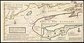
 Description of the Coasts, Points, Harbours and Islands of New France WDL280.png 9,652 × 6,783; 94.71 MB
-
 FMIB 36801 Hauteurs moyennes des Marees dans la Baie de Fundy (Canada).jpeg 779 × 1,093; 246 KB
-
 FMIB 43871 Bay of Fundy.jpeg 865 × 689; 196 KB
-
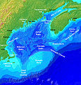 GulfofMaine.jpg 523 × 544; 285 KB
-
 La baye françoise.png 3,409 × 2,121; 12.18 MB
-
-
-
-
-
-
-
-
-
-
 MitchellMap-SouthernNovaScotia.jpg 2,904 × 2,336; 2.6 MB
-
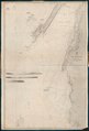
 South-east part of the Bay of Fundy RMG K0473.jpg 1,280 × 495; 396 KB
-
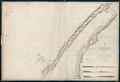
 South-east part of the Bay of Fundy RMG K0475.jpg 1,280 × 483; 448 KB
-
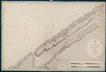
 South-east part of the Bay of Fundy RMG K0476.jpg 1,280 × 501; 442 KB
-
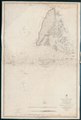
 South-east part of the Bay of Fundy RMG K0477.jpg 1,280 × 527; 492 KB
-
 South-east part of the Bay of Fundy RMG K0478.jpg 1,280 × 503; 432 KB
-
 South-east part of the Bay of Fundy RMG K0479.jpg 1,005 × 1,280; 735 KB
-
 South-east part of the Bay of Fundy RMG K0480.jpg 1,001 × 1,280; 849 KB
-
 South-east part of the Bay of Fundy RMG K0481.jpg 992 × 1,280; 811 KB
-
 South-east part of the Bay of Fundy RMG K0482.jpg 998 × 1,280; 762 KB
-
 Statement-on-the-part-of-the-United-States-Convention-29th-September-1827 MG 9397.tif 3,696 × 3,760; 39.8 MB
-
 Statement-on-the-part-of-the-United-States-Convention-29th-September-1827 MG 9398.tif 3,576 × 3,856; 39.49 MB
-
 Wpdms nasa topo bay of fundy - en.jpg 300 × 230; 25 KB
-
 Wpdms nasa topo bay of fundy.jpg 300 × 230; 15 KB
-
 Wpdms shdrlfi020l bay of fundy.png 300 × 265; 131 KB
.jpg)
_(cropped).jpg)
.jpg)
_Harbour,_Published_1848.jpg)


.jpg)

.jpeg)


.jpg)