Category:Maps of the Borough of Chorley
Media in category "Maps of the Borough of Chorley"
The following 7 files are in this category, out of 7 total.
-
 Borough of Chorley parishes map.svg 1,425 × 1,212; 3.32 MB
-
 Chorley UK local election 2006 map.svg 1,425 × 1,212; 498 KB
-
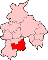
 Chorley UK locator map.svg 1,116 × 1,305; 1.25 MB
-
 Chorley UK ward map 2010 (blank).svg 1,425 × 1,212; 498 KB
-
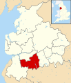
 Chorley unparished area UK locator map.svg 1,425 × 1,212; 494 KB
-
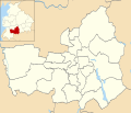
 LancashireChorley.png 200 × 250; 19 KB
-
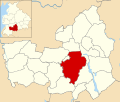
 Location map United Kingdom Borough of Chorley.svg 1,425 × 1,212; 3.97 MB


.svg)