Category:Maps of the Boston Campaign
Maps of the Boston Campaign of the American Revolutionary War in 1775 and 1776.
Subcategories
This category has only the following subcategory.
B
Media in category "Maps of the Boston Campaign"
The following 20 files are in this category, out of 20 total.
-
-
 1775-1776.jpg 593 × 627; 76 KB
-
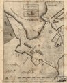
 A Plan oe (i.e. of) the British lines on Boston Neck in August 1775. LOC gm71000627.jpg 2,351 × 2,965; 930 KB
-
 A Plan oe (i.e. of) the British lines on Boston Neck in August 1775. LOC gm71000627.tif 2,351 × 2,965; 19.94 MB
-

-
 Boston 1775.jpg 797 × 776; 250 KB
-
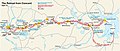
 Boston concord 1775.jpg 1,532 × 848; 156 KB
-
 Concord Expedition and Patriot Messengers-fr.svg 1,019 × 426; 245 KB
-
 Concord Expedition and Patriot Messengers.jpg 1,000 × 426; 139 KB
-
 Concord Retreat.jpg 1,000 × 426; 153 KB
-
 Exact plan of General Gage's lines on Boston Neck in America. LOC 73691645.jpg 2,454 × 2,996; 1.2 MB
-
 Exact plan of General Gage's lines on Boston Neck in America. LOC 73691645.tif 2,454 × 2,996; 21.04 MB
-
 Exact plan of General Gages lines on Boston Neck in America (2674843289).jpg 1,519 × 2,000; 2.72 MB
-
 Exact plan of General Gages lines on Boston Neck in America (2675434424).jpg 1,690 × 2,000; 2.56 MB
-
 Gen. Washingtons Revolutionary campaign war map (2675083506).jpg 2,000 × 1,472; 2.78 MB
-
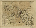
 Lexington Concord Siege of Boston crop.jpg 2,861 × 2,188; 1.89 MB
-
 Lexington Concord Siege of Boston.jpg 3,211 × 2,476; 1.55 MB
-
 Map1775en.jpg 800 × 542; 58 KB
-
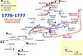 Map1776en.jpg 800 × 542; 64 KB
-
 The Columbian magazine - or, monthly miscellany (3178) (14597575178).jpg 2,982 × 2,002; 1.02 MB
.jpg)

_the_British_lines_on_Boston_Neck_in_August_1775._LOC_gm71000627.jpg)


.jpg)
.jpg)
.jpg)


_(14597575178).jpg)