Category:Maps of the Bristol Channel
Media in category "Maps of the Bristol Channel"
The following 23 files are in this category, out of 23 total.
-

-

-
-

-

-

-
 Admiralty Chart No 1157 Bridgewater Port, Published 1886.jpg 10,964 × 16,209; 68.04 MB
-
 Admiralty Chart No 1176 Newport and Weston-super-Mare to Chepstow and Bristol, Published 1928.jpg 11,094 × 16,244; 72.94 MB
-
 Admiralty Chart No 1178 Approaches to the Bristol Channel, published 1952.jpg 11,114 × 16,211; 36.98 MB
-
 Admiralty Chart No 1179 Bristol Channel, Published 1867.jpg 23,849 × 10,911; 60.88 MB
-
 Admiralty Chart No 1179 Bristol Channel, Published 1906.jpg 24,120 × 11,400; 57.02 MB
-
 Admiralty Chart No 1179 Bristol Channel, Published 1953.jpg 19,205 × 11,370; 72.75 MB
-
 Admiralty Chart No 1181 Anchorages on the South Shore of the Bristol Channel, Published 1884.jpg 16,295 × 12,096; 60.93 MB
-
 Admiralty Chart No 2682 Bristol Channel Nash Point to New Passage, Published 1920.jpg 16,181 × 10,772; 81.87 MB
-
 Admiralty Chart No 36 Bristol Channel Lundy Island, Published 1880.jpg 8,182 × 6,032; 3.78 MB
-
 Beechey Tide Chart of the English, Irish and Bristol Channels Ingoing dated 1848.tif 8,325 × 4,061; 1.65 MB
-
 Beechey Tide Chart of the English, Irish and Bristol Channels Outgoing dated 1848.tif 8,226 × 4,079; 1.65 MB
-
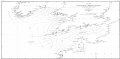
 Bristol channel detailed map.png 600 × 276; 47 KB
-
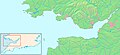
 Bristol channel map.png 201 × 141; 11 KB
-
 Bristol Channel map.png 539 × 381; 5 KB
-
 Bristol-channel-clean-HE.jpg 600 × 276; 167 KB
-
 Bristol-channel-clean.jpg 600 × 276; 139 KB
-
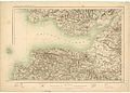 OS Revised Series England and Wales 1-2534400 18.jpg 10,928 × 7,871; 12.85 MB
%27_(11128296686).jpg)
%27_(11167892666).jpg)
%27_(11209405286).jpg)
.jpg)
s_Jefferys,_Geographer_to_his_Majesty_;_To_John_Baring_of..._-_btv1b53056953n_(01_of_12).jpg)
s_Jefferys,_Geographer_to_his_Majesty_;_To_John_Baring_of..._-_btv1b53056953n_(02_of_12).jpg)


