Category:Maps of the Cape Peninsula
Subcategories
This category has the following 5 subcategories, out of 5 total.
Media in category "Maps of the Cape Peninsula"
The following 21 files are in this category, out of 21 total.
-
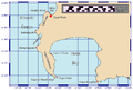
 (de)Map-South Africa-Wester Cape-Cape Peninsula01.png 648 × 655; 128 KB
-
 211 of 'A School Geography' (11157274646).jpg 941 × 852; 170 KB
-
 Cape of Good Hope - panoramio (2).jpg 2,304 × 3,072; 1.42 MB
-
 Cape of good hope 3 - panoramio.jpg 2,048 × 1,536; 1.97 MB
-
 Cape Peninsula.jpg 6,500 × 4,618; 1.25 MB
-
 CapeHopePeninsulaMap.png 816 × 552; 60 KB
-
 Ciudad del Cabo, Table Mountain 07.jpg 4,288 × 2,796; 7.76 MB
-
 Geological map of the Cape Peninsula and False Bay.png 2,793 × 3,505; 2.18 MB
-
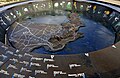
 Geology of Cape Peninsula 1.jpg 4,000 × 5,064; 1.14 MB
-
 Karte vom Süd-Ende Afrika's und dem Cap-Colonie-Lande.jpg 6,278 × 5,273; 7.77 MB
-
 Metro Central Education District.svg 842 × 1,000; 371 KB
-
 Metro East Education District.svg 842 × 1,000; 371 KB
-
 Metro North Education District.svg 842 × 1,000; 371 KB
-
 Metro South Education District.svg 842 × 1,000; 371 KB
-
 Photog Reef.jpg 1,654 × 2,339; 428 KB
-
 Plan of Table Bay with the City of Cape Town WDL533.png 1,404 × 1,024; 2.41 MB
-
 Plano que contiene la Bahía de Tabla con la ciudad del Cabo LOC 90683990.tif 8,473 × 6,178; 149.76 MB
-
 Rigobert-Bonne-Atlas-de-toutes-les-parties-connues-du-globe-terrestre MG 9991.tif 5,230 × 3,564; 53.36 MB
-
 Silvertree Distribution Map - Leucadendron argenteum - Cape Town.png 582 × 474; 599 KB
-
 Table Mountain (Nature Reserve), Cape Town, South Africa - panoramio (41).jpg 3,072 × 2,304; 2.89 MB
-
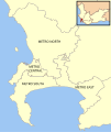 Western Cape urban education districts.svg 842 × 1,000; 374 KB
Map-South_Africa-Wester_Cape-Cape_Peninsula01.png)
.jpg)
.jpg)


,_Cape_Town,_South_Africa_-_panoramio_(41).jpg)
