Category:Maps of the Captaincy General of Chile
Media in category "Maps of the Captaincy General of Chile"
The following 15 files are in this category, out of 15 total.
-
 Captaincy General of Chile (orthographic projection).svg 550 × 550; 844 KB
-
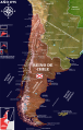
 Bandera mapa de la Capitanía General de Chile, 1775.svg 1,579 × 3,543; 1.35 MB
-
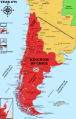
 Bandera mapa de la Capitanía General de Chile, 1776.svg 1,575 × 3,543; 3.19 MB
-
 Capitanía General de Chile, 1775, mapa satelital.svg 1,710 × 2,684; 8.84 MB
-
 Capitanía General de Chile, 1775.svg 1,710 × 2,684; 4.53 MB
-
 Capitanía General de Chile, 1776.svg 1,710 × 2,684; 4.77 MB
-
 Capitanía General de Chile, 1810 (Uti possidetis iuris).svg 1,710 × 2,684; 5.8 MB
-
 Captaincy General of Chile, 1775.svg 1,710 × 2,684; 4.5 MB
-
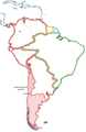
 Chile location map (+claims, 1775).svg 1,710 × 2,679; 2.2 MB
-
 Chile location map (+claims, 1776).svg 1,710 × 2,679; 3.06 MB
-
 Colchagua-1750 01.png 2,550 × 3,300; 3.97 MB
-
 Colchagua-1800.png 2,550 × 3,300; 4.01 MB
-
 Cuyo en la Capitanía General de Chile.svg 1,710 × 2,679; 2.53 MB
-
 Mapa Capitania Chile.png 1,038 × 1,599; 470 KB
-
 Parte sudamericana del Reino de Chile.svg 1,576 × 3,543; 674 KB
.svg)


.svg)

.svg)
.svg)


