Category:Maps of the Central District (Israel)
Media in category "Maps of the Central District (Israel)"
The following 21 files are in this category, out of 21 total.
-
 14-18-ATira-1948.jpg 7,051 × 8,326; 7.62 MB
-
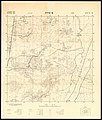
 14-19-Cacoun-1948.jpg 7,090 × 8,350; 7.35 MB
-
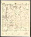
 14-19-KfarHaim-1949.jpg 6,940 × 8,410; 7.36 MB
-
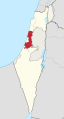
 Central district in Israel.svg 361 × 1,000; 2.33 MB
-
 מחוז המרכז.JPG 183 × 282; 19 KB
-
 Center District in Israel (+disputed hatched) (semi-Israel areas hatched).svg 614 × 1,141; 345 KB
-
 Center District in Israel (+disputed hatched).svg 614 × 1,141; 285 KB
-
 Center District in Israel (+disputed) (semi-Israel areas hatched).svg 614 × 1,141; 342 KB
-
 Center District in Israel (+disputed).svg 614 × 1,141; 281 KB
-
 Center District in Israel (undisputed) (semi-Israel areas hatched).svg 614 × 1,141; 338 KB
-
 Center District in Israel (undisputed).svg 614 × 1,141; 280 KB
-
 Israel center dist.png 262 × 727; 36 KB
-
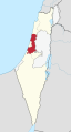
 Israel center dist.svg 540 × 990; 76 KB
-
 Israel-Central.png 100 × 301; 3 KB
-
 Septem-Israel location Center.svg 200 × 510; 81 KB
-
 HaSharon subdistrict in Israel.svg 361 × 1,000; 2.33 MB
-
 HaMeshulash locator map.png 744 × 746; 67 KB
-
 Petah Tikva subdistrict in Israel.svg 361 × 1,000; 2.46 MB
-
 Ramla subdistrict in Israel.svg 361 × 1,000; 2.33 MB
-
 Rehovot subdistrict in Israel.svg 361 × 1,000; 2.4 MB
-
 Map-sharonn.png 986 × 1,795; 833 KB


_(semi-Israel_areas_hatched).svg)
.svg)
_(semi-Israel_areas_hatched).svg)
.svg)
_(semi-Israel_areas_hatched).svg)
.svg)


